Dear Diary,
This is the first of four pages in you that I intend to write to back up my claim, in a not-so-recent mayoral debate, that Seattle too often "throws away" its public amenities. I intend to spend two pages on that central topic, and two pages on relevant background. This page is one of that latter pair, and is getting big enough and time-consuming enough to write that I have to split it into its own pair of pages, too.
When I've written about Magnuson Park before, I've relied heavily on two maps I found early in my explorations of the park. These maps have left me with more questions than answers. I contacted Rachel Schulkin, communications manager for the Seattle Department of Parks and Recreation, who put me in touch with Brian Judd, park manager. When he and I talked, I eventually asked him how long he'd been familiar with Magnuson Park, and when he named the year, told him I was pretty sure what I was asking about was before that. Not long after, he hung up on me. Well, dear Diary, maybe some people who'll read this page would've hung up on me too, maybe I would my own self, but even though Magnuson is quite a young park, it does have some history beyond the present century.
Now I have what, if you sort of squint, you could call four maps, and some of my questions have been more or less answered. I'm now pretty certain that at least seven buildings in Magnuson Park, of which four are now standing, have included public restrooms, probably with doors that open to the outdoors. I therefore think the less official-looking of the maps I was familiar with was probably correct in asserting the previous existence of two more buildings, and have found corroborating evidence for one of those.
In a nutshell, then, Magnuson Park is by far the most important example in North Seattle of the throwing away of park restroom buildings, and that's why proving that, constructing the relative chronology the four maps allow, is central to the view my debate question expressed.
Map #1, 1974
Most maps of Magnuson Park don't bother to indicate the restrooms. There's a map I looked at tonight at Central Library, also available from the Northeast branch, that doesn't, for example. But a few of the maps in the Environmental Impact Statement for the original creation of Sand Point Park from Sand Point Naval Air Station - draft 1974, final 1976 - do show them.
I think the final version, which I looked at at Suzzallo Library in late September, in fact the day I was first pitched the job I'm currently working at, shows all three relevant buildings on one map. However, that version isn't available online, I can't currently get back to Suzzallo, the Seattle Public Library's copy requires pre-arrangements to consult, and in the draft version available online, those buildings are only shown on two separate maps, and two of the buildings are only named in a text page before them. Here those pages are:


The first map shows two structures near the shore. I presume these are the officers' bathhouse and the enlisted men's bathhouse mentioned in the page of text, both of which are given short-term park jobs in that page. The second map has a location labelled "Restrooms".
The Officers' Bathhouse
The Beach Restroom Building
The present building looks old, and may be the building the park inherited as the officers' bathhouse, or it may have been designed in a retro style; I don't know. I very much doubt the interior is much as it was in 1974. Note that not all of the building is open to the public. The most useful document I've had access to on the history of Magnuson Park in general, its "Strategic Development Plan" from 2012, appears to settle the question of the present building's age: it says page 4 that the "Swim Beach Comfort Station" was built in 2010 for $1,100,000, while on page 21 it says that the "Bath House" built in 1941-1952 was demolished in 2009. This strongly suggests the story, but I'm still not quite sure, because the bathhouse demolished in 2009 isn't better identified.
Photos of what I considered the "best faces" of the surviving restroom buildings at Magnuson Park can be found in your page "Hike 2B ... main page", dear Diary. I didn't try to better those photos on Saturday's hike. Google Images didn't turn up images using the search ' "Sand Point" "Officers' Bathhouse" ' nor with a space in Bath House, but I assume photos exist somewhere.
The Enlisted Men's Bathhouse
This is shown on this map and the next, and then not on the remaining two; it was the first restroom building known to me to go; if it was built during World War II, it may not have been very well built, so no great surprise. The text page posted above mentions that it was intended to become an administration building, but it's identified as offering restrooms on the next map. Again, no luck at Google Images, and I'm certainly not going to search for the presumably less photogenic buildings ahead.
Here's what's there now:


The Boat Launch Restrooms
These restrooms are on three of my current maps, including the one I followed in "Magnuson Park: Things We've Lost", one of your first pages, dear Diary. I speculated there that they were too close to the federally protected wetlands to last, but having re-visited the site Saturday, I don't buy it: they're just north of vast parking lots, there are currently three "sanican"s there... Anyway, here's another picture showing what one might expect of land that had had restrooms on top of it for decades, though the presence of "sanican"s, also probably for decades, can't have helped:

Map #2, not yet dated
The official picnic map of Magnuson Park offered by the parks department to this very day is, astonishingly, the second-oldest map I've found. Given what else I know, it must date back to the 1970s or 1980s. It's the map that confirms that the enlisted men's bathhouse offered restrooms, that the restrooms projected at the boat launch in map #1 were actually built, and that the next restrooms built at Magnuson Park were those serving the playground and the dogs' off-leash area.

This map was the key to the chronology, in fact. I'd mis-remembered the location of shelter #1, so I thought this map had erred by omitting the central restrooms, putting the tower restrooms on the wrong side of the shore road, and putting the shelter wrong ... and then finally noticed that it erred in no way at all if I put it into the right chronological place (and got my head out of the sand about that shelter).
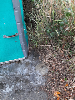
The Park Entrance Restrooms
These are only on this map and the next one. Today part of the area suggested by this map is occupied by one "sanican", at some distance from the others serving the playground; under that object, the concrete is patched, but then, concrete in parking lots often is. The other part is occupied by a lot of bushy vegetation, offering a gap in the trees thereabouts. Basically, if the picnic map didn't confirm these restrooms' existence, I couldn't make much of a case based on the surviving topography.


I have no clue at all why those restrooms came down.
That's all I have time to write tonight, dear Diary. Tomorrow I'll try to finish the story. Good night.
No comments:
Post a Comment