Dear Diary,
I was going to tell you the story of the evening of May 27 today, but with the weather so nasty, I'd rather do something more unambiguously cheerful, such as write about a relatively easy and well-documented trail.
Not that it's that well-documented, or I wouldn't write about it at all; it isn't in my core area, and has no plumbing, so why should I care? Because nobody tells you even the basics of what the trail is like, and, having walked it twice, I think someone should.
Officially, the main attraction of the perimeter trail is that it provides views of the golf course, and it does indeed do so often. But I'm not that interested in views of golf courses, so I'll focus on the path underfoot and on the views in the other directions.
I started, each time, at 15th Ave and 135th St. From here, the trail goes along 135th quite a ways. It's mostly gravel, here; I've parked my cart each time I've walked it. Other parts of the trail are gravel, dirt, wood (bridges), and even pavement (but that's far ahead). Looking outward you'll see parked cars, the road, and eventually a divider of shrubbery and/or trees. This is what's south of you when you pass the trail map near 11th Ave. Here's someone else's photo of the map.
135th turns into 10th Ave not far from 11th Ave, and goes south. The trail follows it for a while, even losing the divider briefly, but can't follow it all that long considering we never see the P-Patch; instead the trail gradually curves westward, for the first time opening up real woods on its outer side.
Soon enough, we're probably roughly paralleling 133rd St, going west, but also going downhill, because we soon bridge Thornton Creek. There are paths right up to the creek's banks. Beyond the creek, the trail rises again and passes several houses, presumably on 8th Ct.
Next we reach 5th Ave. This means I-5's traffic noise is pretty much a constant here, but also, currently, Sound Transit is doing a major construction project, presumably light rail. The entire western side of the trail is within view of the site. Woods do eventually build up for a time, which turns out to herald another bridge over the creek, and doesn't last all that long thereafter. The golf course plays a little joke along here, warning trail users to be quiet and not disturb golfers' concentration, as if the highway and builders wouldn't drown out any noise we made.
There's a triangle of woods at the corner of 5th Ave and 145th St, but soon after comes one of the oldest parts of this fairly new trail, what looks just like a regular sidewalk on the south side of 145th from 6th Ave to a spot between 11th and 12th Avenues. For most of this span, the golf course is high above the trail, so there aren't even those views to take in.
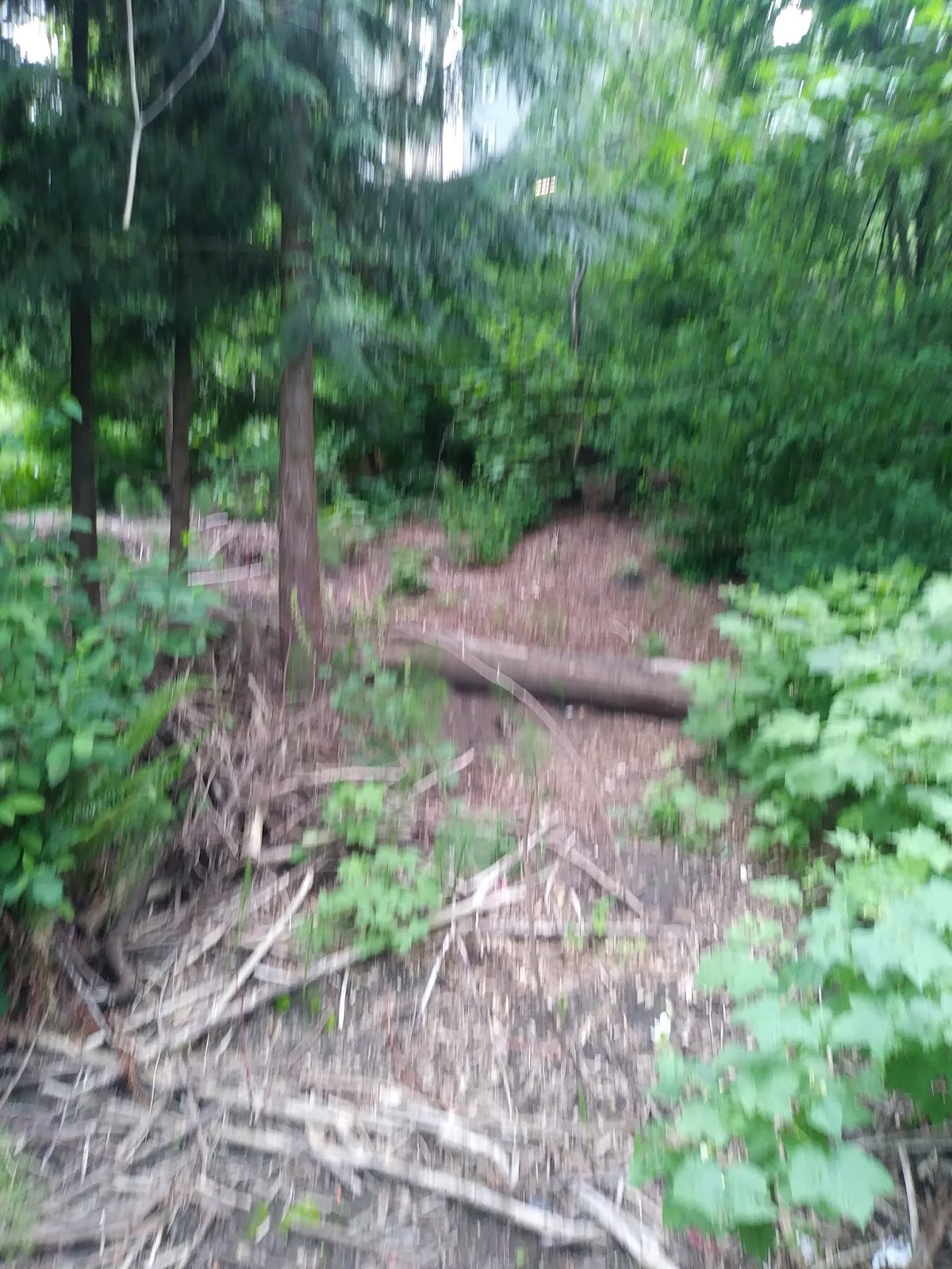
The most complicated and interesting part of the trail comes next, however. There are woods on both sides of the trail at re-entry into the park, and for much of this distance the golf course's fence is far from the trail. We go downhill a ways, then walk past 12th Ave, farther than 143rd St. Up again (the trail's only actual stairs, paved, are here), to a wider woods, especially after 12th ends. Eventually we're behind houses again.
A left turn then brings us to 15th again, about where a 138th St could have been. Again we have a paved part of the trail presciently built as if it were a sidewalk long ago. Much of what's behind the fence here is the part of the driving range that golfers usually aren't in.
Signs throughout the trail have the usual parks boilerplate plus one mysterious declaration: something like "Hike at your own risk." Signs above the 135th St parking explain: The risk is from errant golf balls. I don't know how often such balls reach the trail, but I didn't see abandoned balls on either trip, so my own guess is that the risk isn't large.
So this is a really rather weird trail, what with its eight or so blocks of sidewalks, the elephant in the room that nobody online has mentioned, but I found it worth walking.
I mentioned that on both overnight trips I slept, poorly, in a bus shelter. I didn't find the area around Jackson Park at all promising for an unsheltered homeless person. But several people who've pitched tents in the more wooded areas along the trail evidently have found a way, though for who knows how long.
Dear Diary, I learnt yesterday that a man I knew had died eight weeks before. So I'm in sort of a fey mood, not helpful to writing. I have three main plans for the next week: Tell you about the evening of the 27th; update you on the core parks, including Magnuson; and go to the part of north Seattle where addresses have "N"s, looking for the western boundary, if it exists, of the dry water fountain problem. But I won't make promises as to which days each of those might happen. Until then, dear Diary.
Saturday, May 30, 2020
Friday, May 29, 2020
South to and from Northgate
Dear Diary,
Last night I mentioned that I filled two bottles from Northacres Park's winter-hardened water fountains on May 27. I knew this to be a good idea, you see, because I hadn't filled even one bottle at them on May 15, and, wow, did I suffer for that. There's one more pair of restrooms ahead, open, but not one running water fountain out of only four candidates.
From Northacres Playfield I went, both days, back to 1st Ave, and took it south to 117th St, which passes over I-5 to become another instance of 1st Ave. My map claims there are several ways to leave this 1st Ave between I-5 and Northgate Way, but I think the only one that's actually open is 116th St, and it was blocked by construction on May 15. So that day I had to trudge along the edge of a very tedious housing development, getting thirstier all the time, blaming the builders for blocking the exits at 115th and 112th ... Anyway, I strongly recommend anyone taking this path on foot escape via 116th if at all possible. In a car, you're stuck with 1st, because there's a stairway in 3rd. Ultimately you get to
Hubbard Homestead
Visited May 15 and 27; no plumbing
Of course with a name like that I envisioned a historical site, and I was astonished when I got there and realised I was familiar with this history-ignoring park, as you are too if you've caught the Route 41 southward from north of Northgate. It's basically Northgate North's back yard. The 3rd Ave end has a skatepark, the 5th Ave one benches and a basketball hoop or two. In between, a waving field of tallgrass for which a playground is planned, and I can only hope a water fountain too.
Northgate Park
Visited May 15 and 27; one water fountain, not running both times
This is much like Albert Davis Park, sandwiched between a library and a community center, but much bigger, and without (at least both times I visited) campers. Much of the added space is grassy.
Beaver Pond Natural Area
Visited May 15 and briefly May 27; no plumbing
This is the sacrificial goat of the Thornton Creek system. It's right across 5th Ave from the mall, and it was never going to be a quiet place to watch undisturbed wild things. So they built a nice, easy trail, which has four entrances. The one on 105th St west of 8th Ave doesn't have stairs, but all the others - 104th west of 8th, 104th east of 5th, and 103rd east of 5th - do have stairs. This trail keeps you at a little distance from the creek, so unsurprisingly I found at least two short probably-unofficial trails that go right up to the banks; one starts behind the bus shelter on 5th near 103rd. There are reputedly actual beavers.
The Natural Area extends northeast of the trail system, but I've found no entrances or maps, and strongly doubt any plumbing is hidden there.
Victory Creek Park
Visited May 15 for something like an hour, and much more briefly May 27; probably no plumbing
This park confuses me. It has a sign anmouncing some amenities that have pretty well established meanings in Seattle's park system:

The children's play area should mean at least a little playground equipment, and the picnic area should have at least one picnic table. But the only thing I found even remotely resembling either of these is, um, this:

What I did find is a small park consisting mostly of yet another creek, with woods around it laced with trails. Now, I can't imagine that the parks department is lying here, so what can explain this? I think it's obvious: The amenities are underground, and I just never found their entrance. If you wish to explore this possibility, all entrances to the park that I found are from a parking lot at the QFC on Northgate Way.
Another possibility: That's a fake sign. Once I saw such a one naming the micro-park at Olive and Denny "Four Car Park". This one gets the name right but the amenities wrong. Note the atypical typefaces used.
Anyway, the reason I cared is that in Seattle's parks water fountains are strongly attracted to playgrounds. So if you ever do find the play area, let me know whether it has one, would you?
Speaking of which,
Victory Heights Playground
Visited May 15 and 27; one water fountain, not running either time
This is one of two parks in a sort of pocket neighbourhood south of Northgate Way; this one is down 19th Ave from there. It's next to Victory Heights Cooperative School, and the water fountain is attached to the school building. The playground equipment has several translucent panels high up, that on sunny days cast beautiful coloured shadows.
Kingfisher Natural Area
Visited, from different angles, May 15 and 27; probably no plumbing
At the address Google gives this one, where 17th Ave turns into 104th St, there's a very obvious trail that runs quite straight down to the creek. Initially I settled for that, but I started to wonder, and on the 27th decided to use my head start to explore more thoroughly. I started on 15th Ave, and found at 104th St signs naming the place (absent at the alleged main address) and announcing a trail. This turned vertical almost immediately, and, fed up with shying away from such trails, I parked the cart and went in. Some time later - probably a quarter or even half an hour - I found an unofficial exit where another 17th Ave dead ends north of 100th St. My trail was easy to discern, but it met many other trails, I know of no map, and I think anything from a water fountain to the original Crystal Palace could be hidden here, but probably isn't. The trail I spent that time on is relatively hard, I was very glad I'd brought my umbrella, and frankly amazed I escaped not covered in mud. So I promptly gave up on any more thorough exploration.
On the 15th, though confounded by map errors, I managed to exit the neighbourhood of Victory Heights to Lake City Way, took it to 98th St, and then went south on 20th Ave. This may be the steepest street I've ever climbed, and I can't recommend doing it while pushing a cart and dying of thirst. Maple Leaf is actually one of Seattle's tallest hills, and our next park faces south from near the peak.
Sacajawea Playground
Visited May 15; no plumbing
This is another park that stretches the meaning of Seattle parks' terminology. Sacajawea Elementary School, behind the park, has some playground equipment, but the park has none. It's mostly a grassy indentation in the hillside, surrounded by trees, with one giant tree in the middle. I saw some teenagers there, but no kids.
Downhill, at 82nd St, we get to the only one of these parks with a restroom. I took 15th Ave to it on May 15, but on May 27, skipping Sacajawea, went back to Roosevelt before starting south, which was a much more bearable slope.
Maple Leaf Reservoir Park
Visited May 15 and 27; one pair of restrooms, open both times, and one water fountain (I think), not running both times
This isn't actually a very big park, but it seems limitless. There's a bunch of sport space toward the 14th Ave side, while the Roosevelt side has the playground and restrooms, with the water fountain well hidden north of the latter. I used the men's room on the 15th and it worked fine.
I also finally got desperate enough that day to try something I imagine your readers, dear Diary, have probably wondered at my not doing long since: drinking from the sink. See, I grew up with a fiberglass hot water heater, which taught me to worry about pipes; I figure if the parks people give us both sinks and water fountains, they must have a reason for doing so.
On the 27th, coming south on Roosevelt, I discovered the park's upstairs, which has yet more sport space plus lots of grass space for future sports or present comtemplation. I found, however, no plumbing upstairs. The upstairs does have, on clear days, great views of the city and the mountains; I saw both Mount Rainier and the Cascades.
Both days, I continued down Roosevelt to 75th St (on the 15th buying a can of soda from the Peruvian restaurant on the way). On the 26th I'd taken a bus to Lake City, my first time taking the cart on one, so on the 27th, after visiting the Safeway there (and using its men's room), I caught a bus back to campus. On the 15th, however, I was there for a little park hidden on Banner Place south of 75th.
Rainbow Point
Visited May 15; no plumbing
This is a small park nestled between major roads; it basically exists for its views, with plants strategically placed to edit the roads out of those views. Not a bad place to sit a while.
From there I trudged down Roosevelt to 65th St to cross I-5 for the tour's last park.
NE 60th Street Park
Visited May 15; no plumbing
Since I-5 curves, it repeatedly creates awkward bits of land where it meets grid-pattern streets, and one of those is a small triangular park. At its north end it's wide enough to look like woods; at its south end it's just a line of trees. I saw hints at the north end that someone might have lived there.
Then I hiked south to 50th St to re-cross I-5 and head for campus.
So ends my story of May 14 and 15, but there's one more chapter to the May 26 and 27 tale, which I hope to tell tomorrow. Until then, dear Diary.
Thursday, May 28, 2020
Top of the City, Part II
Dear Diary,
Today's page is about four parks - or five if you count as the parks department does - that are all pretty close to each other, and that, taken together, project an image of an almost normal spring in the parks. Two have no plumbing; in the other two, only one shut-off water fountain attests the current abnormal situation.
They're also all kind of hard to enter, so I'm giving more detailed directions. They're all between 1st and 15th Avenues and 125th and 145th Streets.
Jackson Park
The parks department's website lists 413 parks. It does not, however, list among those Jackson Park. This is partly because it leases much of the park to a private company, Premier Golf. (So this is the flip side of Nathan Hale Playfield and Cedar Park.) Sad to say, this private company does a significantly better job of running things than I've found elsewhere in northeast Seattle. Only two other parks there have all their plumbing working - Burke-Gilman Playground Park and Little Brook Park - and those two have only one or two restrooms and one water fountain each.
Visited May 14, 15, 26 and 27; over four restrooms, at least two pairs open, and at least two water fountains, both running
Jackson Park is, according to the parks department website and signage, two entirely separate not-quite-park entities: Jackson Park Golf Course and Jackson Park Perimeter Trail. Both are easiest to enter from 15th Ave, but the actual entrance to the golf course and the most informative entrance to the trail are further west, officially at 10th, actually best reached from 11th Ave and 130th St. A sign for the trail near that intersection has a map of the trail on its trail-facing back. As for the golf course, from 11th and 130th look around and identify the most active parking lot. At that lot's head, you go up a steep incline to reach the main golf course buildings open to the public.
I don't buy the idea that these are two separate non-parks. For one thing, both have the same official hours, "Dawn to Dusk", which is decidedly non-standard for Seattle parks. However, all the plumbing is in the golf course. I found much too little information online about the trail, so when I get the chance, I'll describe it in more detail. Meanwhile, the golf course.
I didn't visit the course proper, only the cluster of buildings at the top of that hill. There are essentially three - a cafe, which wasn't open anytime I was there; a shop staffed by professional golfers, so called the "pro shop", the course's nerve centre; and a building supporting a driving range, which is free and open to the public. Each of these has restrooms. One pro assured me that all these restrooms are open to the public; another, that no Premier Golf employee would block a well behaved member of the public from them. I'm unsure anyway about the cafe - aren't restaurants in general still keeping their restrooms closed? But the driving range has two single-user rooms; the shop's men's room features several toilets, with the usual privacy features so often lacking for park toilets.
I tried the driving range's men's room; it had hot water, believe it or not, but was out of soap that morning, May 27. (So was BGPP's men's room, for days now. I take this as a good thing, actually - it implies that parks employees are prioritising getting the rooms open, not getting them perfect - though of course in a better world I wouldn't need to carry hand soap.)
The water fountains I found are side by side between the restrooms at the driving range. Of course there could be others. Some talk about how Jackson Park adapted to the coronavirus mentions "restrooms" removed from the course itself, but I'm told these were only, as this implies, "sanican"s.
Licorice Fern Natural Area
Visited May 15; no plumbing
We've already seen with Mock Creek Ravine that individual parts of the Thornton Creek Natural Area can have their own names. It now turns out you can have nested Natural Areas, as here. Licorice Fern has, according to Google, not the parks department, an address, and if you go to that address, the dead end of 130th St west of 12th Ave, you find a greensward with two trails leading away. I followed one, though not far, somewhat shocked by the idea of a trail anywhere near Thornton Creek. (But wait until tomorrow...) I found a map online (PDF) later according to which these two trails are the only ones, and excused myself on that basis from exploring further.
Flicker Haven Natural Area
Visited May 15 and 27; no plumbing
This is the current official name of an area south of Jackson Park, or sometimes considered itself the southwest of Jackson Park. It has also been known as "Thornton Creek Park #1". I haven't been able to reconcile descriptions of that with what I've found except by assuming the descriptions actually refer to the P-Patch which is in the northern end of what Google Maps thinks of as this park. That P-Patch is on 10th Ave just north of a notional 130th St, on 10th represented by an overpass.
The 8th Ave border isn't much more informative. I couldn't tell whether the dead end of 130th St east of 8th included any public property. Where 8th Ave turns and becomes 8th Ct, a trail appears, continuing north in the line of 8th Ave until it descends, probably to merge with the Jackson Park Perimeter Trail.
This page has a sort of map, but at least on my phone it doesn't render well. Evidently people have worked within this area, but I don't know how they entered.
On this trip, I already knew I'd be covering Green Lake and other parks with strictly "N" addresses. There are only two parks west of I-5 with "NE" addresses; since this next one has restrooms, I decided to cover them in this trip and set of pages.
Northacres Park and Playfield
Visited May 15 and 27; two pairs of restrooms (one all-gender single-user), for openness see below, and three water fountains, two running
This park is both terribly and excellently named. It's entirely south of Jackson, Little Brook and Cedar Parks, and it's smaller not only than Jackson and Magnuson Parks but also than Ravenna Park and Matthews Beach. But it still feels like acres, especially along its thickly forested north side, which stretches from I-5 to 1st Ave along 130th St, and it's still pretty far north for most of us. As for its surname: in Seattle's park nomenclature, "park" outranks "playfield"; Magnuson Park has a dozen ball fields, but nobody tacks an "and Playfields" onto its name. This, too, however, makes sense, as I'll explain.
Northacres Park has the less common of the Seattle parks' two usual schedules. It used to have the more common, and in this photo I can only hope you can see the different schedules on the two signs:

The two schedules are 4 A.M. to 11:30 P.M. (the default) and 6 A.M. to 10 P.M. I suspect but do not know that the latter is usually thanks to neighbours. Other parks I've covered that open at 6 are:
Laurelhurst Playfield
Ravenna Park
University Playground
Matthews Beach
Albert Davis Park
The park's official address is on 1st Ave, near a notional 127th St. There one finds a seemingly ordinary park, with two age-specific playgrounds, a basketball hoop crowded by art, and weird plumbing: two single-user all-gender restrooms, with two winter-hardened water fountains attached. The weirdest thing about this not so ordinary park, however, is that in several directions it's surrounded by woods.
I don't remember any issues with the restrooms, which I used on May 15, except that I found them locked. I'd had little luck calling the parks department weeks earlier, but decided to try again, and not only reached someone, but he got multiple parks employees to come unlock them. On May 27 I filled two 20-ounce bottles from the water fountains and found it good water.
The guy who actually unlocked the rooms on May 15 represented himself as the boss of the person who'd forgotten to. He's the one who told me Little Brook's restroom had reopened - he'd done that the same morning. He wouldn't give me his name, but said he was close to retirement; I'll probably quote him enough to get him in trouble if any of his bosses ever read any of this, but doubt the trouble would be serious.
For now, however, I only need to thank him for pointing me to the playfield, which is in a different clearing in the woods, several blocks away. This is why "and Playfield" makes sense to me here. You reach Northacres Playfield by continuing south on 1st Ave, turning left onto 125th St, and turning left again on 3rd Ave. This is a couple of baseball diamonds, a couple of picnic tables, restrooms and a water fountain; on May 27, without a game going, I found it kind of sad.
That day I used the men's room (which was open on both May 15 and May 27). It was poor for privacy, but not as bad as Waldo Dahl Playfield or Little Brook Park. Its sink, however, is of the same design as the one I remember from Cal Anderson Park: spraying so much water horizontally that it's much better for soaking whatever's in your pockets than for washing your hands.
The water fountain, near but not visibly attached to the restrooms, is not running. And that returns us to the real world of northeast Seattle's parks in May 2020, the last ten of which I'll discuss in less detail tomorrow.
Top of the City, Part I
Dear Diary,
Exciting but old news for you, I'm afraid. There are three more parks in northeastern Seattle with both open restrooms and running water fountains, but they're all really far away, and they've all been that way for weeks; I don't know of any newer examples. So I think I've sort of found the northern boundary of the water fountain desert, but not the eastern boundary.
I visited all the parks between the water, the city limits, I-5, Lake City Way, and 110th St on the 14th and 15th, then re-visited those with restrooms and/or water fountains on the 26th and 27th. This page covers the ten parks visited on the 14th and, where relevant, the 26th. I ended up stopping at the same point in each hike, so tomorrow's page will cover the remaining four parks in the northernmost parts of Seattle's northeast. Finally, Friday I'll talk about ten parks further south in the area.
Outlying Lake City
University Lake Shore Place
Visited only May 14. (I had to get directions, because both my map and Google Maps make grievous errors around here.) No plumbing.
Near as I can tell, this is simply a stretch of wooded slope over the Burke-Gilman Trail, just south of 125th St. There's a bench, but it might belong to the trail rather than this, um, park. Speaking as someone who's gone through the entire official list of parks, I'm extremely grateful Seattle doesn't own, and separately name, all the wooded slopes over the trail.
NE 130th Street End
Visited only May 14 (same set of directions). No plumbing.
This is a tiny beach built for the kids of Lake City long ago. Unfortunately it's now kind of hard for most of them to reach. There's a stair from 42nd Ave, but 42nd is kind of a world unto itself, with no contact between it and the rest of Lake City between 123rd and 145th Streets. So the beach is much easier to reach from outside Lake City, via the Burke-Gilman Trail.
Cedar Park
Visited May 14 and 26. One water fountain, not running either time.
This is an elementary school's playground, on 135th St between 37th and 39th Avenues, open to the public as a park except during recesses. It appears to work much better than the similar deal over Nathan Hale Playfield. Most of the people present on my second, mid-afternoon, visit were of elementary school age. It's basically a playground plus a grassy area, which turns out to be a common design.
Little Brook Park
Visited May 14 and 26. One restroom, closed May 14, described to me as just reopened May 15, open May 26. One water fountain, running May 14 but rather more strongly May 26.
Dear Diary, I didn't make a mistake there. Little Brook Park (formerly known as Lake City Open Space, on 32nd Ave north of 140th St) doesn't have one men's room and one women's, or two all-gender, or two anything. It has one restroom. That room is lockable:

but unsurprisingly that deadbolt has been disabled:

This restroom's privacy issues don't end there. It's ventilated by holes in the walls at top and bottom, and although it took me some work, I was able to take these pictures


of the then-closed room through a bottom hole. A woman would have to be pretty desperate or pretty stupid to use this room. I was uncomfortable using it myself yesterday.
The rest of the park seems to be playground plus grassy area, but I didn't look for the namesake creek in or beyond the grass.
Downtown Lake City
Albert Davis Park
Visited May 14th and 26th. One water fountain, not running either time.
This is a small park sandwiched between the Lake City Community Center (in which I detected no signs of life) and the Lake City branch library. On my first visit, it was dominated by an encampment of my peers, concentrated on the south side of the park; I saw mostly black people there. Yesterday the tents were much more spread out (socially distanced) and I saw some white people as well as blacks. The camp is equipped with two "sanicans" and a hand-washing station.
Lake City Mini Park
Visited May 14 and 26; no plumbing.
This is a sliver of land which on the 14th was dominated by an encampment in which I saw mostly white people. Yesterday, though it was still crowded with tents, I thought it shrunken, but saw some black people among the whites. This camp also has two "sanicans" and a hand-washing station.
I talked with one gentleman living there May 14. He called Little Brook's working water fountain a "treasure" but admitted that the camp's main source of water (or at least his own) was neighbours' outdoor taps.
I want to emphasise this to you, dear Diary. I often praise our wonderful mayor, but this may well be her masterstroke. By leaving two water fountains turned off, she simultaneously saves the city money, and converts any number of private citizens into benefactors. Isn't that heartwarming?
Lake City Memorial Triangle
Visited May 14 and briefly May 26; no plumbing.
If I've correctly identified this, it's a small triangle in front of some buildings, across the street from the previous park. It's supposedly a memorial for some specific young men who died of violence, but I haven't found any plaques. It's dominated instead by a gigantic ad for a bank, a very big ad for a VA clinic, and a big ad for a restaurant.
Virgil Flaim Park
Visited May 14 and 26; at least one water fountain, not running either time.
Yes, in case you've been keeping count, that's the other water fountain in downtown Lake City that our wise mayor is keeping off. This park, probably bigger than the other three downtown parks put together, southwest of them, is largely grassy but includes, besides the playground, a skatepark. I saw no tents, but many of the vehicles parked near there on the 14th, and some on the 26th, looked inhabited.
There's lots of room at this park for the restrooms Lake City ought to have, which won't fit at Little Brook.
Pinehurst
Pinehurst Pocket Park
Visited May 14; no plumbing.
This is a very pleasant park the size of a one-house lot, with various pieces of art. It's at the corner of 117th St and 19th Ave.
Pinehurst Playfield
Visited May 14 and 26; one water fountain at least, running both times.
This park, on 14th Ave north of 120th St, isn't small, but because it's very steeply sloped, it doesn't feel as big as it actually is. Besides the requisite baseball diamond it has a basketball half-court, a shelter house (which I doubt has ever included restrooms), and I don't know what-all else. The water fountain gives good water. This is where I spent yesterday evening.
I spent the nights of the 14th and 26th in the same bus shelter.
I spent the nights of the 14th and 26th in the same bus shelter.
All for today (well, technically yesterday now), dear Diary. Fewer parks, in more detail, tomorrow.
Sunday, May 24, 2020
Going to the Masque of the Dull Death
Dear Diary,
You may have noticed that I'm not writing in you from the usual place this weekend. This takes some explaining.
You see, I recently broke the one rule homeless people must never break at the University: I slept on campus. This is what I was doing when my backpack was stolen, in fact, so I've already been punished. But also, this has led the University's police to settle a disagreement against me.
See, some people think any time I empty my cart, I'm setting up a camp. Now a University police officer has explained to me that this is true, and therefore I may not remove my satchels from the cart on campus.
This situation has inconvenienced me, and has also posed some peculiar questions for me: Does a campsite require an empty cart, or was I automatically camping every time I brought my satchels onto campus without a cart, for years? If I used a different kind of cart, would that make a difference?
But it's mainly good news. See, if all it takes to set up a camp is to empty my cart, then obviously when at night I also empty the satchels, and build my bed, I must be doing something much grander: setting up an ENCAMPMENT. And that in turn qualifies me to be swept.
Now, in your pages, dear Diary, I've already explained how sweeps can entertain or even ennoble us, so I'm sure you see how this could be good news. But it's much bigger than that.
Everyone knows that the only way to get housing help in Seattle is to have your grandparents sign you up for it when your parents are born, but this is not actually quite true. Five categories of homeless people can skip the line.
Two because it's proper: Veterans can jump ahead, as can parents of small children, and nobody should gainsay them that.
Two because it's practical: It may not be much comfort for the rest of us, but it does society some good when petty criminals or troublemaking addicts get housed out of turn.
But for most of us, the only serious chance for help is to be swept. No, really, dear Diary, I know this sounds crazy, but I read it in the newspaper, so it must be true: Get the attention of a Navigation Team member, and you can get housed. And since my own encampment is just me, surely I could get their attention if I were to be swept.
So just think of it, dear Diary. Any time now, I could become just like a normal person, complaining about having to stay inside all the time, instead of complaining, as I do now, about having to stay outside all the time.
This kind of reversal seems characteristic of my life recently, and the case of masks - no, dear Diary, this page's title isn't "bait and switch" - is obviously related. Many homeless people - many of the sheltered, and most of those unsheltered who sleep in neither tent nor vehicle, like me - Many of us are effectively "in public" all the time. What does a recommendation to wear masks whenever "in public" mean to us?
I told you some time ago I hadn't worn a mask once. But I bought one from a profiteer weeks ago, just in case I caught the virus and needed to go to a hospital. So when the directive came down to wear masks in certain indoor contexts, of course I did as I was told. But this has made me even more aware of how others see me, when I'm masked, when I'm not. I got a few days off from the quandary since all my masks were in my backpack, but now I have more, and have started, experimentally, wearing them a bit more.
Friday, the day I got the new masks, I went downtown (Freeway Park's restrooms still closed, water fountains running in Pioneer Square but not in Occidental Square), among other purposes to get the charger that allows me to write in you, dear Diary. And somewhere downtown I came across a letter blowing in the wind, a letter written by one of my peers. I got his next of kin's permission to present it in you.
To my friends:
Like most of you, I used to think all these face masks were just the latest craze among the housed, not something we homeless could or should concern ourselves with. But then I saw an article in The Seattle Times that explained how and why we homeless people should wear them too.
I had to think about it a bit, but finally I concluded that in times that turn grocery workers and pizza delivery guys into heroes, this is our own chance at heroism. Sure, I'll miss eating and drinking, but it'll only be for a few days, right?
Tell ____ ________ about this, please. ___ is my next of kin, but hasn't been proud of me for years; now I can finally hold my head high in front of ___ again, at least in spirit.
~~~~~~~~~~~~~~~~~
Something to think about, dear Diary. I'm going back downtown tomorrow, and then putting new wheels on the cart. Then I expect to spend a few days visiting parks and telling you all about them.
Saturday, May 23, 2020
Odds and Ends
Dear Diary,
It's so good to be back! Have you missed me? As much as I've missed you?
The Thursday and Friday before my backpack's theft, the 14th and 15th of May, I visited something like 27 parks in something like 29 hours. I want to be fair to a lot of them about their plumbing, so, since it's been so long, I'll have to re-visit them before I can tell you about them.
But the ones in this page shouldn't need re-visiting, because none of them have plumbing to be fair about. Heck, the first goes all the way back to May 12, when you may have noticed I took a long time to get from Cowen Park to University Playground; that's because I visited en route


I also stopped at Meadowbrook while in the neighbourhood, and so can now attest that its men's room works fine.
It's so good to be back! Have you missed me? As much as I've missed you?
The Thursday and Friday before my backpack's theft, the 14th and 15th of May, I visited something like 27 parks in something like 29 hours. I want to be fair to a lot of them about their plumbing, so, since it's been so long, I'll have to re-visit them before I can tell you about them.
But the ones in this page shouldn't need re-visiting, because none of them have plumbing to be fair about. Heck, the first goes all the way back to May 12, when you may have noticed I took a long time to get from Cowen Park to University Playground; that's because I visited en route
University Heights Plaza
It turns out much of the city block on which the former school, University Heights Center, sits is the property not of the non-profit that runs the Center, but of the Seattle Department of Parks and Recreation. It's astonishing how many parkish amenities they jam into the space, regardless of which entity owns the land under each:

A playground, of course.

A P-Patch.

A basketball court. But there's one amenity not there; I'll let the Center explain:

(Well, at least one. I haven't found any water fountains either.) As if to make up for this, there's currently this:

I saw several not obviously homeless people use these while I was there.
This is the last of the little, plumbing-free parks I listed as local some while ago, at least as far as I know.
Leftovers
Skipping ahead to Thursday the 14th, I decided to start my trip to Lake City with visits to the three remaining little parks in the area I'd already covered, up to 110th St. I took 35th Ave north, partly because I thought (correctly, thankfully) it might have sidewalks the whole way, and partly because all three parks are pretty near it.
Wedgwood Square
Seattle has a lot of streets that share their names and general latitudes or longitudes with other streets. I like to use the computerish term "instance" for these. For example, one instance of 82nd Street, a very small one, runs from 34th Ave to 31st Ave. There it's divided by a triangle. And this triangle is Wedgwood, um, Square. It's full of trees, and on that afternoon also of kids. There definitely isn't room there for a restroom, and I saw no sign of a water fountain.
Mock Creek Ravine
This park's official address is actually on 35th, but all you'll find there is a fence. However, if you go down 97th St, just north, pretty much to its end, you'll find, first, that this is yet another piece of the Thornton Creek Natural Area, and, second, that it has a fairly big grassy, level area at its front door. However, just like all the other TCNA pieces, it lacks plumbing.
Nathan Hale Playfield
I mocked my old map for claiming each high school was surrounded by a park, but in this school's case, it's sort of true. The parks department has several deals with other entities, in which one party owns the land, the other manages it; here, the Seattle Public Schools own, but the parks department handles some of the management. (Since the substantial Meadowbrook establishment is next door, this may be as simple as equipment sharing.)
In theory, when school isn't in session, the general public can use the field. In practice, since this is a high school, it can't possibly be that simple, school teams practising in morning, evening, and summer. I don't know whether you'd get into trouble if you just wandered over alone and, not seeing kids, started running laps, but the school officially bars unauthorised visitors, and you'd have to be an idiot to bring a team there without prior arrangement.
Anyway, apparently right now, since the school is closed, so, according to the school, is the playfield, park or no park. I saw several people climb a fence to get in. In my previous out-of-neighbourhood trip, my phone was very low on power, so I didn't take any pictures, consoling myself that the parks I was visiting weren't my real focus. This time, I took a few, but more or less of the door shot variety, not neat stuff shots. Dueling signs at Nathan Hale Playfield:

And yes, that's the fence people were climbing.
There are a bunch of buildings near the playfield, and for all I know some might have plumbing, but I doubt any are open to fence-climbers.
There are a bunch of buildings near the playfield, and for all I know some might have plumbing, but I doubt any are open to fence-climbers.
The page with the rest of Thursday the 14th's parks will feature another such deal, and the page with the parks I visited on Friday the 15th will describe one the other way round, with the parks department as the landlord.
I also stopped at Meadowbrook while in the neighbourhood, and so can now attest that its men's room works fine.
All for now, dear Diary. Isn't it great to be back?
Saturday, May 16, 2020
Tiresome news
Dear Diary,
My backpack was just stolen. It had in it the charger for the phone on which I take pictures for you and write in you. The phone is low on power right now, so I have to turn it off until a new charger comes. Sorry, dear Diary; I'll miss you.
My backpack was just stolen. It had in it the charger for the phone on which I take pictures for you and write in you. The phone is low on power right now, so I have to turn it off until a new charger comes. Sorry, dear Diary; I'll miss you.
Wednesday, May 13, 2020
Down by the Canal
Dear Diary,
Four more of the little local parks I've been ignoring are close to the ship canal. As befits the location, only one of these is mainly about its land; but as if to make up for that, three of them have regular Seattle parks signage.
(For anyone keeping score at home on the basis of the lists I wrote in you, dear Diary, last week, I goofed and left two of these out of them, thinking they were west of I-5. In fact, one is east of it, the other under it.)
Fritz Hedges Waterway Park
The parks department website speaks of this in the future tense, and in this case they aren't out of date (although the projected completion date is):

It sounds like it'll include some land and also have a boat ramp. It's on Boat St, not far from Recycled Cycles.
The next two are the ones I mistakenly omitted from my list. They're both on the south side of the block of Northlake Way between 6th and 7th Avenues.
Northlake Park
The website's discussion of this explains what it is not, who owns it, and other confusing topics. Near as I saw, it's a viewpoint; sorry I screwed up the photo:

It does have a park sign, though:

This is the one I left out that's east of I-5.
North Passage Point
This is the one, of these four, that currently is mainly about its land, which is directly under I-5. I saw a couple having a picnic and a man sleeping. (I sure wish someone would do something about all us homeless people!) As you may have noticed, I try to leave people out of the pictures I post here, not wanting to negotiate image rights while socially distanced, so I had a hard time getting a shot of the four geese present:

It does, of course, offer another view of the water:

And its paved path has lots of insets, alternating simple and complex; I picked this one not as a favourite, couldn't choose, but because of a graffito on the pavement there, of a scared-looking ghost, in red, that I can only hope you can see in this photo:

Peace Park
This isn't on the canal, but is essentially built into one of the bridges over the canal, the University Bridge. I didn't remember that it's a formal park, rather than an unexplained collection of similarly themed artworks:

The park sign calls this sculpture "Sadako and the Thousand Cranes", and I've seen many origami cranes left there, but Seattle weather being what it is, on this visit there were Easter candies instead. Nearby:


I've often wondered what wonders might lie down the stairs from the area I knew, but never enough to find out with my heavy satchels. Sorry, though, it isn't all that exciting after all:

Anyway, it's easy to miss the park sign, which is the furthest from the bridge of the park's main elements:

All for now, dear Diary; I decided to combine the other post I'd considered for tonight (University Heights Plaza) with some other loose ends coming up. Wish me luck, dear Diary: I'm setting out tomorrow on a long hike with the damaged cart. Until we meet again!
Back East, Where the Gardens Are Pretty
Dear Diary,
The title of this page is an example of something called "bait and switch". That is, I'm going to tell you about parks to the east that are near many pretty gardens, but I'm not actually showing you any pictures of those pretty gardens. Sorry!
This time of year, of course, many gardens are gorgeous. But these three parks are in rich neighbourhoods where just about all the gardens are - at least now - gorgeous. The parks, of which I will show you pictures, vary in beauty.
I visited them Monday, the last day of the heat and the first of the current occasional rain. Monday morning as usual I went to Burke-Gilman Playground Park for water. There was a pleasant surprise: the dryer in the men's room had been fixed. I stayed around for a while, doing my current morning routine, but then headed to the first park despite the rising heat.
University Circle
This is a traffic circle. It isn't all that close to the UW; instead the name refers to the fact that all the streets thereabouts are named for universities. The circle, in particular, is where Vassar, Ann Arbor and Princeton Avenues meet. It's up a very steep hill from BGPP, which I probably shouldn't have climbed in that heat. It's the prettiest of these three parks this time of year:


Belvoir Place
After I recovered from the climb and descent, sometime around 3 P.M. (I don't deal well with hot weather), I went to Safeway and got breakfast, starting to eat it as I headed for the other two parks. This made me something of an evildoer, because those two are southeast of University Village, past the lands of the Center for Urban Horticulture with its varying levels of "Leave No Trace" ethos, and it's hard to leave no trace of having eaten tortilla chips in a strong wind.
Anyway, though, if you take Mary Gates Memorial Drive, it eventually turns into 41st St (the least reasonable way to Laurelhurst Playfield). A short way on, 41st intersects Surber Drive, where private land with pretty gardens starts. Surber ends at 42nd Ave, down which you'll find Belvoir Place the park, which even has a sign. There are, according to my map, two streets near there named Belvoir Place; I noticed the further, some blocks from the park, but not the nearer.
Belvoir Place the park is a small access, for people and for small boats, to Union Bay. The neighbours on each side have matching big boats, somewhat dominating the view. I'm quite sure this simple park doesn't hide a restroom; I could conceivably have missed a water fountain, but I really doubt it.


Union Bay Boglands
Once you've found Belvoir Place the park, it's a simple matter to go back down Surber and, by a process of elimination, figure out how to enter the part of Union Bay's surviving bogs that belongs to Seattle, as opposed to King County (Belvoir Pump Station) or the University (Yesler Swamp). The Seattle park part starts with stern but anonymous warning signs:

OK, I guess they aren't very readable; the yellow letters are, of course, "No Parking", which you see me violating with my cart just then, while the white sign off to the left says "Dump No Material Whatever". There's a paved road, of all things, and it does lead to plumbing, but only in the form of the aforementioned Belvoir Pump Station. Confusingly, the signs at the bottom of this drive are from the University:

One of them warns that the boardwalk can be slippery when it rains; I think it means this:

I didn't venture nearly far enough into the boglands to find that boardwalk, just stuff like this:

But as I walked away I did find something genuinely neat - carvings in an ordinary fence:

All for now, dear Diary, but I'll probably write two more pages in you later today, because I expect to be gone for a few days after that.
Tuesday, May 12, 2020
Ravennawards
Dear Diary,
Something momentous seems to have happened recently, dear Diary, but I greatly fear it's been done all wrong. It's also partly old news. I think I should start at the beginning.
Which is a correction I forgot to include in my errata page a few days ago. Do you remember...


Finally, today (Tuesday, May 12, 2020), I found Ravenna Park's lower restrooms locked at 11:44 (A.M. PDT), the upper ones unlocked shortly before 12:07 P.M., Cowen Park's locked at 12:22, and University Playground's locked at 1:10.
The conclusion seems inescapable: This work - not only of opening the rooms, but taking care of them - was done either by parks workers without authorisation, or by,private citizens.
Two months into the pandemic, twenty-four hour access to running water has reached the U-District, but only thanks to renegades or trespassers.
You will respond that this is a good deed for the numerous homeless people in the area who can now find toilets, sinks, and drinking water all in one place. But that's precisely my point. Our wonderful mayor would undoubtedly have gotten around to this good deed. She might even have done so before the end of the pandemic. And now the opportunity has been stolen from her by some nobodies. It's lèse-majesté, that's what it is, and I trust she will invoke the full majesty of the law against the perpetrators. Good deed? Bah, humbug!
EDIT: I'm delighted to report that tonight at about 10:30 P.M., when I tried to use the upper Ravenna Park restrooms, I found them locked. Probably the nightly locker of restrooms got to the park, found the lower ones already locked, and looked around for something else to lock. So it all worked out for the best.
Nobody had yet read this page of you, dear Diary, by the time those restrooms were locked.


Something momentous seems to have happened recently, dear Diary, but I greatly fear it's been done all wrong. It's also partly old news. I think I should start at the beginning.
Which is a correction I forgot to include in my errata page a few days ago. Do you remember...
Ravenna Park I
I claimed a plastic stall door in the men's room of Ravenna Park's lower men's room was new, and probably put there because vandals had wrecked the old metal door.
Well, the door could perhaps be new, but the graffiti on it aren't; I recognised several from last summer:


Hope they're visible in those shots. They're upside down; that much, anyway, has changed since they were made.
I've warned you, dear Diary, about my unreliable memory, and this is an excellent example.
So anyway, this past weekend, I needed to do Number Two in the late afternoons, which meant trips to Ravenna Park. I decided not to stress the damaged cart with these trips; on Sunday I anyway brought my backpack, but Saturday and Monday not even that. I decided to use these excursions to visit also the smaller parks more or less near Ravenna, of which there are four. On Saturday I began with
Ravenna Woods
Two streets lead south from the western end of the lower part of Ravenna Park. The eastern is Ravenna Place, the western Ravenna Avenue.
Well, if you follow the Avenue south past the dead end notice all the way to 47th St, you reach Ravenna Woods. Like Inverness Ravine Park, this one lacks the usual signage (as, in fact, do all four of these), but unlike both that park and Thornton Creek Natural Area (EDIT 10/19 Chinook Passage Natural Area), Ravenna Woods has a clearly laid out, gravel, path.

This continues Ravenna Avenue south to 45th St; just south of the overpass, the woods continue but the path becomes wood chips and makes a sharp right turn.
I remember a miserable night or two, years ago, of verifying that none of these trails lead acceptably back to the street system.
In looking for parks' restrooms and water fountains, I assume they're meant to be found. Magnuson Park's central restroom is on a gravel path, but it's a path central to the park. Or to put it another way, plumbing that nobody can find is effectively nonexistent.
There's no visible plumbing on the gravel path, and I don't see the point in checking wood chip trails at all.

I was, therefore, unhappily familiar with these woods, but although they're a terrible way to get somewhere, they aren't such a bad destination in their own right.
I was rather more familiar with a place further north on Ravenna Avenue, where a stair in three parts goes up to 20th. Before the cart, I used to use that stair, sometimes in the rain, which meant I couldn't put any of my satchels down for its entire height.


This time, even without satchels, I wimped out of the third and easiest part, after climbing the second and hardest, shown above. The bottom of the stair is next to a P-Patch, at which, Saturday afternoon, someone was watering; so I guess I should count P-Patches in parks (such as Magnuson Park) as examples of plumbing in those parks.
On this excursion I passed two groups of young people who weren't practising social distancing. One was seventeen men in front of a fraternity house; the other was three men and a woman in front of a shack, behind which lay three tents. It sure is great that our excellent mayor here in Seattle can be counted on to do the right thing in these cases. After all, pandemics come and pandemics go, but it's always essential to punish the poor.
Ravenna Boulevard
This is a greenway running from Ravenna Park to Green Lake Park. I'm familiar with it up to Roosevelt, in which stretch it includes an official park with signage but not listed on the website, Olga Park. (EDIT 10/19 - Not an official park.) It does not, however, that I've ever seen, include restrooms or water fountains. When I go to Green Lake I'll take this route and cover it more fully; as a down payment here are the blocks I normally see on my way from campus to Ravenna Park via 20th, shot from their lower ends.


Park Home Circle
The first two intersections on Ravenna Boulevard are with Park Road, a small semicircle north of the boulevard; at the second the road continues south as 21st Ave. Park Home Circle is a traffic circle somewhat frivolously placed within the semicircle. You can see it from the boulevard:

Parents, if you take your kids to this one, have them approach it from the east,

so they can find this micro-park's claim to fame for themselves.

so they can find this micro-park's claim to fame for themselves.


Ravenna Ravine
So I decided Sunday afternoon to finish the job by going to this one. After all, how hard could it be?
Several weary miles later... To reach Ravenna Ravine, or anyway what the parks department website calls by that name, you have to start from 25th Ave. Turn onto 60th St into a micro-neighbourhood festooned with "dead end" signs. Near the north end of this area's main street, 24th Ave, the address actually given by the website is a forbidding clump of bushes:

but just north of there, an actual trail invites the wayfarer. Alas, it ends in a cliff a few feet in:

I guess it's clear from the photo that a path seems to lead left (south) there. I followed this about ten feet south and two feet down before accepting that I'm no longer the intrepid explorer I used to be and clambering, with some difficulty, back to the street. The path went further, visible every foot or two, almost as wide as my foot. So I haven't really explored Ravenna Ravine, but I'm pretty confident it lacks restrooms and water fountains.
I'm not clear on to what extent this ravine connects with the ravine further south in Ravenna Park, on which more below. Remember, the parks department doesn't do maps; Google Maps opines that they're two separate parks with private land between them.
Ravenna Park II
It was just after 8 P.M. when I got back to Ravenna Park's lower restrooms, which were locked. So I went to the upper restrooms before calling it a night - and found them unlocked. Not only that, but the men's room had acquired soap, and its clogged toilet had been fixed. So why was this open when the main restrooms, the lower ones, were locked?


One hint: Only the women's room was (and is) actually open; the men's room, whose door can be seen from a nearby parking lot, was unlocked but closed. (The open door in the photo above was propped open by me, only long enough to take the picture.)
Another: At 1 A.M. that night, I set out to University Playground, Cowen Park, and Ravenna Park, and found only Ravenna Park's upper restrooms unlocked.
A third: Monday evening, just after 7 P.M., I found Cowen Park's restrooms locked, with the leafpile still at the men's room door; at 7:40 P.M. Ravenna Park's lower restrooms were locked; but at 7:50 the upper ones still weren't.
Finally, today (Tuesday, May 12, 2020), I found Ravenna Park's lower restrooms locked at 11:44 (A.M. PDT), the upper ones unlocked shortly before 12:07 P.M., Cowen Park's locked at 12:22, and University Playground's locked at 1:10.
The conclusion seems inescapable: This work - not only of opening the rooms, but taking care of them - was done either by parks workers without authorisation, or by,private citizens.
Two months into the pandemic, twenty-four hour access to running water has reached the U-District, but only thanks to renegades or trespassers.
You will respond that this is a good deed for the numerous homeless people in the area who can now find toilets, sinks, and drinking water all in one place. But that's precisely my point. Our wonderful mayor would undoubtedly have gotten around to this good deed. She might even have done so before the end of the pandemic. And now the opportunity has been stolen from her by some nobodies. It's lèse-majesté, that's what it is, and I trust she will invoke the full majesty of the law against the perpetrators. Good deed? Bah, humbug!
EDIT: I'm delighted to report that tonight at about 10:30 P.M., when I tried to use the upper Ravenna Park restrooms, I found them locked. Probably the nightly locker of restrooms got to the park, found the lower ones already locked, and looked around for something else to lock. So it all worked out for the best.
Nobody had yet read this page of you, dear Diary, by the time those restrooms were locked.
Ravenna Park III
On Monday, after checking that Cowen Park's restrooms were still locked, I knew it was too late for locked rooms at University Playground to mean anything, and hadn't the heart to go on anyway. Meanwhile, on this trip I'd noticed what looked like a paved path in the ravine north of Cowen Park, so I wanted to check that out. I'd been imagining Cowen Park, which is considerably lower than most of the streets that surround it, as a kind of spreading-out of the ravine; is it?
Well, not really but sort of. Cowen Park is significantly higher ground than the ravine proper, but does provide access to it. Unfortunately the paved path turned out to be gravel, and for most of its length old, mostly buried gravel. There was a lot of this:

and enough of this:


that I can't say the ravine lacks running water, but it does lack plumbing. Someone had tried to live there anyway:

I suspect, but don't know, that that's the result of a sweep. Now, these days most sweeps are done on the basis that the camps swept are "obstructions". You might notice that the only thing this camp obstructed was some trees, and wonder about that. But this shows an inadequate perspective. Many trees in forests are obstructed by undergrowth, or fallen trees. Therefore, obstructing trees is a subhuman, vegetative thing to do. It's for his own good that this camper was swept, to restore him to his rightful place as a human being. Never let it be said that our wonderful mayor lacks compassion.
Anyway, there were lots of side paths, but the main path leads to the bowl in lower Ravenna Park, which actually is the sort of widening out of the ravine that I'd imagined Cowen Park to be.
Subscribe to:
Posts (Atom)