Tuesday, June 30, 2020

The Ballard Seacoast: Parks Not Parks', part I

Dear Diary,

Yesterday morning I woke up with a bunch of dishes to wash, so it was clearly time to go back to Laurelhurst Community Center's hot water taps.  Since the Playfield's water fountains still aren't on, I then had to hike to Burke-Gilman Playground Park for drinking water.  Now, I've made this trip before, but I'm not actually all that observant, so this was the first time I noticed a park on 47th Ave NE.  It's called SUN Park, and it may be owned by Forterra, which was Cascade Land Conservancy before discovering the joys of hiring consultants.  A couple of photos:

There are actually lots of parks and park-like places around town that have nothing to do with the City of Seattle's Department of Parks and Recreation.  Just for starters, many of the public elementary schools open their playgrounds' doors to the public on a schedule.

My choice to focus on Seattle's official parks has been justified by one thing I've yet to see any other kind of park do:  offer running water in toilet, sink, or water fountain.  That is, of course, why I started writing you in the first place, dear Diary.  But that doesn't mean I have to ignore all the other things parks do.  One of which is, offer beaches.

I came to Seattle the day I turned 39, and even before then wasn't much of a beachgoer.  So although I knew of, and had even been to, Magnuson, Gas Works and Green Lake Parks before moving north in 2014, I hadn't much clue about Golden Gardens or Carkeek Parks before this spring.

But these are two of only four Seattle Parks' parks on the Ballard seacoast.  There are eight other places that offer public access to the coast, for some value of "offer", as far as I know.  One of them even offers restrooms and water fountains, just not in its park-like areas.  It would be asinine to leave them all out.

So the page's title isn't really a paradox.  Many of the parks here aren't Parks'.  That's all.

When I left Sunset Hill Park, around 4 P.M. on June 23, my next destination was Eddie Vine Boat Ramp.  The map quickly showed that the only sane way to get there was to go all the way back south to the Ballard Locks, whose east gate I'd taken in the day before:
and choose the road not taken, which has dozens of names, but which for simplicity I'll here call Seaview.

So to start with,

The Ballard Locks

er, that is, I mean,

(United States Army Corps of Engineers) The Hiram M. Chittenden Locks and Carl S. English Botanical Gardens

Google Maps says the gardens actually pretty much dwarf the locks for sheer area, but there's at least a sense in which the locks represent the end of the canal and the beginning of the sea.  However, as is the case for Woodland Park's Zoo and Rose Garden, both are coronavirally closed.  Speaking of dwarfing, what I could see of the gardens from the outside consisted largely of extremely tall, straight conifers with reddish bark:
Anyway, from the west gate begins a gravel track that I explored on the 23rd.  All the parks I found can easily be reached from the adjacent Burke-Gilman Trail, but are more easily found from the gravel track that actually links them.  The first actually precedes the gravel.

(Seattle Public Utilities) Salmon Bay Natural Area

This presents itself as pretty much a viewing area with some benches.  The first time I went, I met a homeless couple, the man white, the woman looking Native American.  He told me it was tribal territory, a former burial ground.  I couldn't find it in the city's real estate report, so I suspect he was right, but anyway the signage is Seattle Public Utilities'.  There's a Native-looking statue, sculptor Marvin Oliver:

I think this photo of a view that I shot yesterday must be from this spot:

At the next interruption in the fence south of the Burke-Gilman Trail, if you look back east you'll glimpse

(?) Seaview Picnic Park

This is a very poorly documented place which would've been called "NW Market Street End" if it had been named consistently with its northern neighbours.  It's got a "Public Shore" sign, but whichever agency owns it doesn't seem eager for credit.  To fit its name, yesterday I photographed its view and its picnic tables:


(Dear Diary, we've been seeing things lost from the delay in writing in you about this trip - if nothing else, I've forgotten most of the excruciating hills - but this page and its sequel are solid gains, incorporating photos and explorations on the 22nd, the 23rd, the 24th, the 26th, and the 29th.)

The next interruption in the southern fence has something of interest besides a park; it has another disabled Burke-Gilman Trail street water fountain:

but of course it does also have a park:

(?Seattle Public Utilities) NW 57th Street End

This is the first of these actually providing access to the water, so it's less about the views.

I vaguely remember people fishing there on the 23rd.  Notice that gritty black and white sand; there's more of that ahead.

NW 60th St Viewpoint

I hadn't been quite sure the wonderful viewpoint at the end of 60th St was really the park so named because I hadn't found its sign.  So you can imagine how I felt when I rounded a corner and saw this:
right where it was supposed to be on Seaview Ave.  It has benches, unlike the viewpoint above it; that late afternoon, those were occupied.  Here's a view of Magnolia, not from a bench:

(Private) Point Shilshole Beach

Google Maps was my guide in this middle part of the trip, and it said there was a beach and put-in roughly level with 64th St above the bluff.  You reach it either by walking a narrow public access path or by cutting through the parking lot of a long-suffering neighbour.  Rules are posted:
but I still don't have a clue how it makes its owners any money.  I didn't explore much (and so can't assess Google Maps's curious claim that part of this beach is public), because it was crowded and because I was totally unprepared for this:
I'd seen no sand at NE 130th Street End and only a silly fringe of it at Matthews Beach, and had started to think Seattleites objected to sand.  Guess not.  Marvelling, I continued north to

(Port of Seattle) Shilshole Bay Marina

and marvelled again when on the place's front door I saw a sign:
There are probably more "No Public Restrooms" signs in the U-District than hours signs; it was a shock to see the opposite.  The building's hours make the advertised restrooms uncompetitive except for people who get caught short on the long hike up Seaview.

Much of the length of that hike consists of the marina itself, which runs from about the equivalent of 68th St right up to the next park at not-80th.  As seen from Seaview, most of that space is parking for cars, but I expect the surface lots are so big largely to match the water room needed.

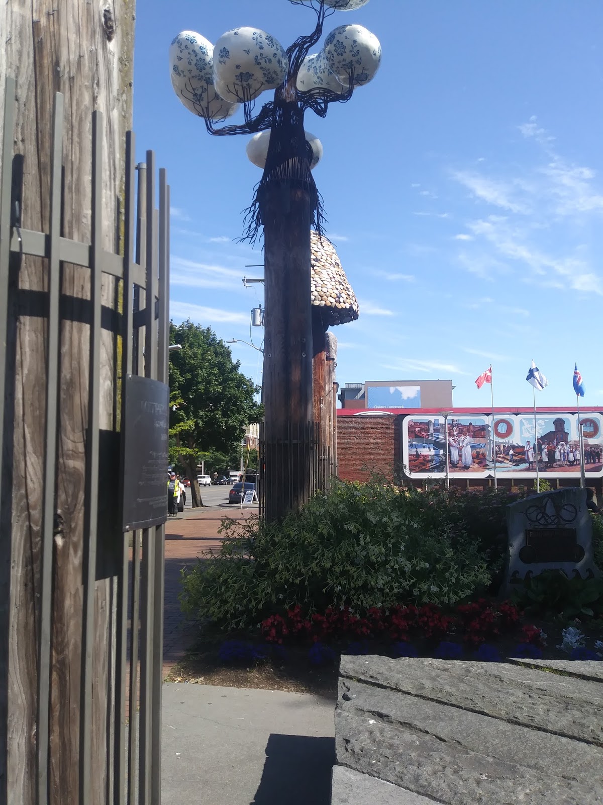
Anyhow, the park-like elements are in a much smaller area around not-74th.  They include, besides the welcoming building (the main office), an area with benches behind the building, a garden south of them, and furthest south, a statue of Leif Erikson:
However, a sign at the garden says it's temporary, just until a new restaurant occupies the spot, at which point the benches will presumably become its outdoor seating.

Continuing north we finally reach

Eddie Vine Boat Ramp

The parks department may choose to treat this as a separate park from its much larger northern neighbour, but it sure doesn't post anything on the ground to warn when going from the 24-hour ramp to the currently much shorter hours next door.  Now, even if I hadn't heard about it, I figure Golden Gardens Park is one of the famous parks I won't photograph - at least, it currently closes at 8 P.M. - so it's a good thing the rom-com-ready pier from which I photographed these views is next to, and I claim part of, the boat ramp.

The first is of the beach, and I suppose it's my first in you, dear Diary, to include people by intent, but I don't think anyone's identifiable.  In the second, I figured I'd shot the Olympic Mountains enough times, so I tried to get the Olympic Peninsula north of the mountains.

Let me leave you there for a time, dear Diary, with me looking at Golden Gardens Park but refusing to admit I'd already entered it.  Both my visits to that park, the night of the 23rd and, um, various daylit times on the 24th, I made sober and sensible decisions that should be recorded for the instruction of younger generations, and I need to think about the most serious way to do so.  I hope to write not only that page, but the following one that belongs to today, before night, but we'll just have to see.

Sunday, June 28, 2020

A Lazy Day on Loyal Heights

Dear Diary,

The last page got well into the evening of Monday, June 22, but I wasn't quite done.  There was one more place left named for Ballard.  And it was becoming clear that bus shelters would be terrible places to sleep on weeknights - in Ballard (and "NW" generally) they only seem to build shelters for routes that run 5 A.M. to 1 A.M.  So I needed to do as my peers do and sleep in parks, and Gemenskap Park was hardly a good choice for that.

So I crossed 65th and went on to the third set of parks.

Ballard Pool

Yes, all the pools are closed due to the pandemic, but that doesn't mean I should ignore them.  What if one had outdoor restrooms, like some community centres?

But Ballard Pool is even closeder than the others.  Turns out there was a general update to all the pools last year, and Ballard Pool drew the short straw for unexpected problems, pushing it into the coronavirus shutdown.

And no, not that I could see that well through the fences and whatnot, but it doesn't seem to have external restrooms (or water fountains) either.  It's on the Ballard High School grounds, on 67th St just east of 15th Ave, if you want to look for yourself.

Off to 9th Ave and 70th for

Kirke Park

This is a medium-small (just under an acre) park whose historical focus is even odder than Ballard Corners's thing about five-and-dimes.  Turns out it's on land that used to belong to a cult, only since this was long ago it was called a church instead.  They were into long hair and vegetarianism, but unlike the hippies, also celibacy, and like most celibate cults died out in the end.  The Seattle Department of Parks and Recreation website says the things I liked best, the ridiculously perfect ruins decorating the area where park gardens shade into the P-Patch, really are the ruins of the cult's buildings.  Some pictures:


Before taking those, I slept in a park for the first time since I was newly homeless, back in 2012.  Which reminds me:  In general, I did not see my peers in the parks north of 65th described in this page.  I may well have been the only person sleeping in Kirke Park that night.  I felt relatively safe doing so; the park has unusually many trees shading it.

6th Ave NW Pocket Park

This tiny park is all playground in my memory, though the department website says (and shows, with photos) there's also a lot of grass.  The website and I prefer the same aspect of the park - its architecture - but they like its details, while I just thought it hung together beautifully.  That said, they have a version of the same shot I took to demonstrate:
Next a long hike, across 80th St I think, to

Loyal Heights Playfield and Community Center

Having lived eight years on "Capitol" Hill, I have a certain fondness for, shall we say, aspirational neighbourhood names, and I amused myself this day imagining a Disloyal Valley, or Mountain, somewhere else.  Alas, turns out the area was named for the developer's daughter, and he probably didn't name another the opposite.

Anyway, as already mentioned, the Community Center here has restrooms built in with external doors, similarly to the Ballard and Laurelhurst ones (the ones at Green Lake and Magnuson differ more).  Neither Ballard nor Loyal Heights takes advantage of this setup to offer hot water as Laurelhurst does, however.  The restrooms at Loyal Heights do have lockable doors, but lack dryers.  Now, it occurred to me that because I once wrongly said Ravenna Park's upper restrooms lacked dryers, you, dear Diary, might not believe me about all these "NW" parks' restrooms, so I took a video to try to show you:

Like many parks, the playfield here is on two levels.  The upper one has the main community centre doors, a box painted blue with "Police Box" written on it but actually holding a free library, a playground, and a water fountain near that last, not running.  The lower part has the baseball diamonds and the restrooms, with a water fountain near each, not running.

From there it was just a couple of blocks south on 20th Ave to 

Salmon Bay Park

where I arrived around 8 A.M. to find the restrooms closed.  I called at 8:13 to find out whether they were supposed to be, and despite some confusion occasioned by the park's name (it's nowhere near Salmon Bay) eventually learned that the doors should be open.  So I found a shaded bench, and waited.

This was not the quick service I'd seen at Northacres Park.  Someone arrived at 9:24, opened the men's room, and started cleaning it.  Presumably they then repeated this at the women's room, but I'd already used the restrooms at the Community Center, I'd eaten calories for breakfast, and it must have been pretty close to then that I fell asleep.

This is why I had to correct my mistake about my shopping on the 22nd.  See, I started this trip on the 21st with most of a box of my usual weekend cream cookies, a day behind schedule.  So I had no business buying calories on Monday the 22nd.  But when I walked into the Safeway near downtown Ballard that day, I saw ads for a sale on their house brand of ice cream.  They used to sell a few flavours in this brand really cheaply, and for the first few years of my homelessness I bought one carton per summer, to give myself lazy days.  Then they got fancier with their house brand, more than doubling the price, so I've only had ice cream since then if I got to a Fred Meyer in the summer.  But this sale was for the old price.  So I bought a flavour they'd never offered at that price, close to my favourite, but as it turned out not close enough, and I didn't finish the carton.  Anyway, for some reason the lazy day was offset by one.

So I slept there on nothing but cream cookies, well past the bench's becoming sunny, waking around noon.  Of course I needed the restroom again, and of course it offered neither a dryer nor privacy, so I took a picture:
I'd already taken pictures of neat stuff.  The neatest thing about Salmon Bay Park is its rolling landscape, on which practically all the paths are paved.  This photo probably doesn't do it justice:
I also liked some tiles in the playground, although as I traveled on I kept seeing the same ones, which somewhat dampened the liking:
Finally I set off down 70th St towards

Webster Park

This small park is on 68th St near, but east of, 32nd Ave.  I'm pretty sure this is the park I vaguely remember only being able to approach from the west (i.e. 32nd) thanks to construction.  It's dominated by a playground, but I do remember it having grass, benches, etc., and resting for a time there.  EDIT JULY 3:  It has a water fountain too, which was running that day, but only in a trickle.

All the art is carefully separated from the playground so as to not to endanger the kids with it; it consists of a sundial by Chuck Nafziger and a set of four bas-reliefs by Charles S. Bigger called "Crossings", three side by side with words I couldn't read apparently telling a connected story.  Scrunched together as they are, they rather get in the way of photography, but here are my best tries:


Next north on 32nd to

Sunset Hill Park

OK, so the parks department website shows benches, and I remember people lying on the grass, but I still think this park at the edge of the cliff on 34th Ave between 75th and 77th Streets is all about its views.  It expresses this by putting a fence along the top of the cliff, and having its only trail run mostly alongside that fence.  I wasn't there at sunset but here's what I could do:
At this point I realised I couldn't get to my next destination from where I was.  I needed to go back south, and find a path to tomorrow's topic, dear Diary, the Ballard seacoast.

Saturday, June 27, 2020

A Heavy Mile Stone

Dear Diary,

Yay!  I'm back where the living is, um, less hard.  I'd hoped to revisit Magnuson Park, Matthews Beach, and Meadowbrook Playfield today; that didn't work out.  But I did visit, mostly for the first time, well over fifty other parks.

The last six or seven were today, though, which means I got soaked.  So I'm too busy drying stuff tonight to write at length in you, dear Diary.

At this point I've visited almost every park I found in North Seattle in the following two sources:

  1. The parks department list which begins with this page (as of May 7), and
  2. The 2019 City of Seattle Real Property Report (PDF).
I omitted some parks with "N" addresses in both lists because they're actually south of the canal; these include Wolf Creek Ravine Natural Area, Northeast Queen Anne Greenbelt, Bhy Kracke Park, Denny Park, Kinnear Place, E Queen Anne Playground, Lake Union Park, Ward Springs Park, Lake Union Walkway, Trolley Hill Park, Counterbalance Park, and probably others (that list draws only on source 2).

I also skipped two park properties in North Seattle, also from source 2, that I thought unlikely to be actual parks:  Parks North Shops, and Morningside Substation Site.  

I've been unable confidently to identify two and one half parks:  Cascade Place, Victory Creek Confluence Natural Area, and one of two Blue Ridge Places.

I'll have to travel some this next week doing the revisits I skipped today and tying up some loose ends, but I think I'm done visiting parks for the first time, looking for neat stuff, and so forth.  After this trip is fully written up I have one more project to do, and one more pass through the nearby parks, and then it'll be time to start drawing conclusions and wrapping you up, dear Diary.  I hope you're looking forward to that as much as I am.

Thursday, June 25, 2020

History and Parks, part II

Dear Diary,

I planned this trip with a fairly simple method:  having mapped all the relevant parks, I then grouped them by picking big arterial streets, and went either east to west (as in this first group, south of 55th or Market Streets) or west to east.  So the next two parks (first group) represent the beginning of downtown Ballard, but I then go pretty far west (second group) before returning to downtown.  This second group covers 55th/Market to 65th Streets.

Parks north of 65th place much less emphasis on history, or at least on Ballard's 18 years of independence or its settlers' Scandinavian roots.  To put it another way, they're less boring than some of these.

Two small parks in south downtown Ballard

These are actually on the same block of 22nd Ave; about where the first stops, the other starts across the street.  I reached them by taking Leary Way from Fred Meyer, then Ballard Ave, which meets 22nd at the first.

Marvin's Garden

This is not one of the boring ones, as long as you're careful.  It's a small space stuffed to the gills with plaques, but the only ones you need to read are those identifying "Marvin":
Anyway, my guess is that the people who made this park were so obsessed with plaques that they left all the landscaping to someone or ones who knew what they were doing.  So in spite of the fact that it's essentially a concrete plaza surrounded by less than fascinating plants, it has a rightness to it that money couldn't buy; not that I really know what I'm talking about, but I feel that this is a Classical garden.  A big part in creating this aura is played by a bell tower:
Unfortunately, all this is a considerable contrast with

Bergen Place

I don't trust my memory when it says this has less of a plant border than Marvin's Garden, but I do believe that my initial impression was of a typical downtown windswept concrete plaza.  It's meant to honour Seattle's sister city relationship with Bergen, Norway; I think I found it more crowded than such plazas usually are, but I still didn't think it did much honour.  That said, the park flies the five Scandinavian flags, and I always like the surprise of seeing a non-American flag in the air:
EDIT 6/29:  I saw a sixth flag from the bus today, so figured I should investigate if time allowed, which it did.
     The reason this park is more popular than a typical bare windswept plaza isn't hard to find:  It isn't bare.  As I suspected when writing the above, I'd forgotten a plant border, sandwiched between benches and pillars, the latter topped with things I did find icky.  Observe:

   As for the sixth flag, I dunno.  It's longer and narrower than a normal flag, and in Norwegian colours.  It isn't a flag of Bergen, but could be a military or maritime variant of the Norwegian flag.  I decided to make a video to make the flags clearer:
As I understand it, they are, left to right and order of focus in the video, Denmark, Finland, Iceland, Norway, Sweden, uncertain.

From there I took Market St past the National Nordic Museum (and to be fair, ate lunch on a bench they provide) to the Ballard Locks (or rather their gates), but I'm saving them for two pages from now, maybe within a day or two.  Our next stop also isn't a Seattle city park, but it took me a whole day to figure that out.  See, I went up 32nd Ave to

A viewpoint on 60th St that is not the NW 60th St Viewpoint

There's a railing at the end of 60th - the westernmost 60th in town - and that railing affords an evidently popular but surprisingly complex view.  The complexity is because you can, from that railing, see not only the water, and the Olympic Mountains across it, but also the much nearer Burlington Northern Railroad.  Oh, and northernmost Magnolia.  So I took four pictures.  The train:
The Olympics behind the train:
Magnolia behind the train:
And the Olympics without the train:
Next I hiked back to 32nd and south to 58th and 

Thyme Patch Park

This is a small, pleasant place, shady in a summer afternoon, where I caught up on my notes and rested.  It has no plumbing except that required by the P-Patch.  It has two styles of art, and for once the one I liked is the one credited.  Roses added to the entry rails by Chuck Nafziger:

(The other art is goofy-looking frogs.)

A hop and a skip away, at 60th and 28th Ave,

Ballard Playground and Community Center

This is one of only two Community Centers in "NW" - the other is in the next page, which I probably can't write in you, dear Diary, today.  In contrast, "NE" has six.  ("N" has two.)  Two of "NE"'s (Laurelhurst and Magnuson) and both of "NW"'s have external restrooms, as does Green Lake in "N".  (I plan to reach Bitter Lake, the other "N", later in this trip.)  Of "NE"'s two, Magnuson's are seasonal and weren't open when last I checked; I've found all the other external restrooms open.  (A revisit to Magnuson is for later in this trip.)  Is anything wrong with this picture?

Anyway, yes, Ballard Community Center has two restrooms open, I think ungendered, one of which has a working dryer.  The double water fountain nearby was not running, even though it's this set's westernmost; that remains true the rest of the way north.  So no, I haven't really found a western border to the dryness, just an isolated western working fountain, like Burke-Gilman Playground Park's in the east.  (As I write this, not having bought and carried a gallon jug, I'm parched.)

Ballard Playground is, as usual, proudest of its playground.  I liked both a formal sculpture by Chuck Greening, "Ballard Boat", and an uncredited piece of playground equipment behind it in this shot:
(The piece I like is the tall one I see as black with white polka dots in the photo.)

Improvements planned seem not to have universal approval:

Ballard Commons

Despite the famous sweep at a time of no sweeps, the first thing I saw of Ballard Commons both times I went there (along 57th St) was a tent.  And if Gilman Playground got the best of those swept, those who stayed put or have returned can't be too far from the worst.  On each visit a loud dispute broke out shortly after I arrived.  Why do they stay in such an inauspicious place?  One reason might be that it has a triple, running water fountain.

The park's biggest claim to fame is, believe it or not, the "Portland Loo", in other words, a "sanican" variant identified with another city.  There are also three more conventional "sanicans", and two hand-washing stations besides that built into the "Loo", which was out of water while I was there.  I don't get it.  First you design a park - a classic downtown windswept concrete plaza, at that, a design notorious for repelling the housed - to attract the homeless, and then when we show up you kick us out?

So iIt does have a skatebowl, and the seashell sculptures through which, in other years, water flows for play, are cute:
Also, when SPL stopped offering Wi-Fi at Ballard, I started being notified of a "Ballard Commons Free Wi-Fi".  But I never got it to work, and it's the opposite of communal anyhow.

Interested people are aware of what one might call the site's terrible feng shui.  They want to add a playground, and that would probably help.
But it might not, with an existing playground so close.  And I'm not sure you can sidestep a place's essence.  Ballard Commons is downtown.  Shouldn't it have something less common?  My thought was a bandstand, not just a literal stand but with outlets for electronic equipment, and maybe a well-built shed for a piano.  Well, whatever; it's not really my business.

But if you want the homeless out of Ballard Commons, give us water supplies elsewhere, for Heaven's sake.

Ballard Corners Park

This small park is at 17th Ave and 62nd St.  It basically features two sculptural re-creations of mid-20th Century life, with a very short trail between.  The park is where an old convenience store used to be, of the kind I can remember from my own early childhood elsewhere, and the park is very proud of Nathan Arnold's soda counter.  But if you approach from the south, you'll see Arnold's other sculpture first, and I won't spoil the surprise.

Gemenskap Park

One aspect of Seattle's current mayor's administration that's been surprisingly little discussed is her revival of former mayor Mike McGinn's road diets, which in his hands were hugely controversial.  Admittedly, the most obvious example is quite recent, so there hasn't been time for full-blown hysteria; I mean, of course, the "Stay Healthy" streets.

But here's another.  This one is actually a literal McGinn legacy:  the planning began in his term, burbled along under the intervening mayors, and the park opened in 2018 under the current mayor.  Basically, Gemenskap Park is two lanes subtracted from 14th Ave between 59th and 61st Streets and turned into a park.  It's essentially grass in one lane and a wide promenade in the other, and the night I visited was very popular.

All for now, dear Diary.  My feet are killing me from standing typing, and I need to find things to drink.  I should next have Wi-Fi when I reach the Broadview branch of the library, luck and SPL willing, and then be writing at a steady clip when I return to campus.

History and Parks, part I

Dear Diary,

Monday June 22 I went from Fremont, which treasures quirk, to Ballard, which treasures history.  Ballard used to be a separate city (for 18 years) until it agreed to annexation by Seattle, and it never lets the visitor to its parks forget it.  (To be fair, though, most of this insistence is in parks I don't get to until the next page.)

Anyway, I've been very liberal with photos this trip, and I was worried some would disappear, as they sometimes do when my camera gets crowded, so I tried to post that night.  Unfortunately, the Ballard public library turned out to treat internet access the way many public buildings treat electricity - free inside, but forbidden out.  So here I am at the Greenwood branch days later with a huge backlog, and I'll just have to see how far I can get.  I probably won't fully catch up for days to come.

After the Fremont Canal Park below, everything address-wise is "NW" for pages and days to come.  Other things I encountered less constantly, but still many times every day:  crows that disapproved of my existence, and would chase me for a block or two to tell me about it; and winds that disapproved of my taking notes on paper, and scattered those notes so many times that last night (June 24) my inseam split on my 854th retrieval dive.  Finally, until I say otherwise, you have to assume that I saw my peers, at and between many of the "NW" parks; it would be invidious to call out all the campers, so I only mention my fellow homeless when I have a point to make.

I EDITED this page Sunday June 28 on looking at my receipts and finding I'd misreported my grocery shopping.

I EDITED it again Monday June 29 on revisiting Sunset Place and probably Cascade Place.

First a leftover from Sunday night.

The Burke-Gilman Trail

It didn't occur to me until I experienced it that because the trail goes under bridges, it offers the chance to watch them split from below.  Not actually as impressive a sight as watching that mountain of bridge rise in front of you when you're on it, but maybe interesting still.

A. B. Ernst Park

This hasn't closed for its expansion construction yet, but the writing is literally on the wall:
The fence shown there doesn't block the trail yet, but it will - construction is planned for August.  The sign includes a map:
This makes it clear that the existing park's dubious main attraction, some Brutalist concrete benches, will not survive in its present form.  Now, I've never seen that thing as "neat stuff", but I have no objection to documenting something soon to go, so:

Apparently when they're done the trail will go all the way down, no stairs needed, so I'm altogether happy.

The non-Jurassic parts of Fremont Canal Park

Apparently they squeeze the Fremont Fair into here every year, so talking about this park is probably coals to Newcastle, but anyway there's something sort of neat.  There are four odd pieces of furniture along the park's length, at least one in the "NW" part.  Three of them, including the "NW" one, are surrounded by bushes, as if to disguise them as incipient topiary.

And one is a chess bench.  I have something of a soft spot for chess benches; one of my last student newspaper stories was about them.  More precisely, about what proved a successful attempt to destroy a chess community by splitting its benches up, so it's kind of perverse of me to highlight this solitary one, but anyway, a chess bench disguised as topiary:

Fremont Canal Park gives every sign of abandoning parkness for trailness well before its notional end at 3rd Ave NW, but if you stick it out that far, you can go straight up 3rd to:

Ross Park

This park is three blocks west of Fremont Peak Park, and probably about three blocks down from it.  It's the only park in this page that isn't open 4 A.M. to 11:30 P.M.; Ross keeps the less common 6 A.M. to 10 P.M. schedule.  There's some dispute about the name.  The Seattle Department of Parks and Recreation website calls it "Ross Playground".  The park's scoreboard calls it "Ross Playfield":
But I'm going with the park's main sign:
Anyway, this was my first stop with a restroom.  The water fountain wasn't working, of course, but the restroom worked fine.  (I won't be saying that about most "NW" park restrooms.)

One bit of neat stuff is in the playground, which sort of successfully carries through the spider theme suggested:
But there's something neater between the restrooms, a mosaic whose makers' names I haven't found:
From there I continued on 3rd to...

A small neighbourhood with four very small parks

The neighbourhood is one I'd glimpsed, because it's just west of Woodland Park Zoo.  The first park I reached is

Sunset Place

This is a triangle, a rather tall one with some benches at the top to take in whatever view can be had at 1st Ave and 52nd St.  My first reaction on seeing it was "What a good use of space!", and I stand by that.  But I didn't climb up to the benches, which was apparently foolish of me, because the parks department website seems to say there's a water fountain there.  Sorry!

EDIT June 29:  OK, now I have.  And there is indeed a water fountain up there, a bizarrely familiar elementary school model, but it RUNS!  This means all three working water fountains in "NW" are south of 60th St.  Sorry, I didn't taste the water.  But here's a picture of the fountain and the park:

The Mystery of Cascade Place

This time I'll actually quote the parks department website, which in a single sentence:
This turnaround island at the end of Palmer Court NW is in Ballard just west of NW Market St at NW 52nd St.
manages to get at most two things right.  This park was the subject of the first question I addressed to Rachel Schulkin, Communications Manager for the department.  (I'd tried to reach her before but never gotten an answer; this turned out to be because I hadn't asked specific questions.)  Anyway, she answered but didn't sound certain; going by her answer, it does exist, it is at an end of Palmer Court, and it is technically in Ballard.  It is not, however, a turnaround island, near 52nd St, or just west of Market St.  I took a bunch of pictures.  First, the situation.  Palmer Court is a short gravel street that heads southeast from 2nd Ave some feet south of 52nd St.  The address given by the department, not that those are always reliable, puts Cascade Place at the interior end, where there's no turnaround island, but is a bunch of greenery.  This is where Google Maps and Ms. Schulkin say it is.  Presumably it's a different part of this greenery from this one:
I also took pictures of both ends of Palmer Court:

and of 52nd St just west of Market St (specifically, Baker Ave and 52nd)
just to show the absence of traffic islands.

EDIT 6/29:  On the premise that the park, if it exists, must be at the interior end of Palmer Court, I took a video of that end today.  I think the likeliest candidate for parkhood is whatever is at the top of the low steps seen in the video, but given the "PRIVATE PROPERTY" sign and a loudly barking large dog nearby, I thought there was too much chance someone with a shotgun was what's at the top of those steps.  Anyway, the video:

Rainier Place

This triangle is where 53rd St intersects with 54th St, I am not making this up.  The department website gets only one thing wrong, calling it "grassy".  It is dominated by a conifer tree whose generic name I should but don't know, and the needles discourage grass from most of the space.

Greenwood Triangle

This triangle is at 3rd Ave and 55th St, strictly speaking across the street from the weirdly laid out small neighbourhood, and actually is grassy.

Next west on Market up to 9th Ave.

Gilman Playground

This extends from 54th past 53rd, but private houses fill half the second block; it runs one long block from 9th to 11th Avenues.  At 4 acres it's bigger than Ross (2.35) let alone the others.  So it has a restroom and water fountain, but here's what's strange:  both work!  I was so gobsmacked I took pictures to establish a chain of evidence.  Working water fountain:
That water fountain is near this restroom:
And that restroom is in Gilman Playground:
You see, I'd gone on a quest for the hypothetical western boundary of the dry park water fountain problem, and I'd found it!  Admittedly, at the westernmost park water fountain in that part of town, but you can't have everything.  (Remember, I hadn't yet found the water fountain at Sunset Place.)

The men's room has a lockable door, but no dryer.

By far the neatest thing I saw Monday at Gilman Playground was an absence.  There were a lot of tents in the park, and some visibly homeless people (including me) outside them.  There were also a lot of visibly housed people there.  And they were all minding their own business.  It was such a refreshing change from the usual park interactions within either group or between the groups.  I concluded that when Ballard Commons was swept not long ago, all the best-behaved of my peers had come to Gilman Playground, but I sure don't know why the housed were behaving so well.

I eventually decided to photograph some drums in the playground.  Plastic, they aren't loud, just audible enough to get across the acoustics lesson of differently sized instruments:

From Gilman Playground I went to the nearby Safeway and got the day's groceries, about which I'll talk more when posting about the 23rd.  But then I headed south for one more park, dear Diary, after which I have to stop writing you for a while, but I'll try to return today.  This is the 14th Ave NW Boat Ramp, and isn't close to any other parks.  Unlike the Sunnyside Ave N Boat Ramp, it had no "sanican" that day.  I took a picture of its seascape:
Then, having done Number One at both Ross and Gilman, I discovered an urgent need to do Number Two.  So I went to Fred Meyer, and paid for the use of their restroom (which also lacked drying capacity at the time) by buying a map of the Eastside there.

Next page, today, I hope, covers downtown Ballard.