Showing posts with label Magnuson. Show all posts

Thursday, September 12, 2024

A Requiem for Seventy-Seven Bus Stops, part VII: The Route 28 north of NW 97th Street; also, beaches and buses

Dear Diary,

No, I didn't sleep enough.  How about you?

Anyway, though, this is the last big heave of this page.  I want to talk not only about the sad collection of stops closing in the far northwest, but also about beaches, and bus service thereto.

I visited most of these stops on Saturday morning, then went back Monday afternoon, having found that Open Street Map maps three stops I'd ignored.  One of those, however, turned out not to be closing, because it's also a stop on the route D.  I also had doubts that two other stops (which I hadn't ignored) were really closing, but that was because I was applying the wrong standard of evidence to the new schedule; I should've been using preponderance of the evidence, not beyond a reasonable doubt.

See, the map shows a transfer point, no less, at NW 100th Place and 7th Avenue NW.


However, the schedule clarifies:  northbound trips end at that stop, stop #28680, where people can indeed transfer (to the route D).  But southbound trips, having turned at 3rd Ave NW and then at Holman Road NW, can't reach the stops across the street from the transfer point, and so they start instead at NW 97th Street:


This is apparently the way the route has worked ever since the extension north became a commuter-only route, which may be all the way back to when it started, for all I know.  (This extension is on the 1973 transit map but not the 1970 one.  The 28 reached NW 105th Street by the time of the 1965 map, but not further north.)  For some reason, none of my copies of the schedule map the Holman-route turn-around used by the non-commuter runs.  Now that every single run uses that turn-around, though, there's no excuse for not showing it.

As before, the links in the lists of stops go to my Google Drive, to folders there containing at least one photo of each stop listed.

Anyway.  The stops:

3rd Avenue NW

Northbound, three stops:

Southbound, three stops:

  • Stop #27790, south of NW 145th Street.
  • Stop #27810, just south of NW 140th Street.  A photo of a bus stop with none of the amenities I'm following:


  • Stop #27820, just south of NW 137th Street.
     

NW 132nd Street

Northbound, one stop:

  • Stop #28850, halfway between 4th Avenue NW and 3rd Avenue NW.

Southbound, one stop:

  • Stop #27840, just west of 3rd Avenue NW.  This is one of the two closing stops on this route that I missed on Saturday.

8th Avenue NW

Northbound, two stops:

Southbound, two stops:

NW 125th Street

Northbound, two stops:

  • Stop #28800, just east of 8th Avenue NW.
  • Stop #28780, just east of Eldorado Lane NW.  This is the other stop that's actually closing that I missed on Saturday, probably because my attention was on a chat with a resident across the street.  While I was photographing it on Monday evening, the 28 bus actually pulled up and stopped.  I saw plenty of 20 buses while walking that route; few 73 buses Saturday evening, but several yesterday; but that was the only commuter bus I saw.  I wasn't on the 322's route at the right times, either Sunday or yesterday.

Southbound, one stop:

  • Stop #27890, east of 8th Avenue NW.  At this stop, someone had recently installed a new cement pavement.  (Most, but not all, of the stops north of this one are unpaved, like stop #27810 above.)  Who paid for that apron, the home-owner, Metro, or someone else?  What will become of it now?  Does the home-owner get to use it for a grill, or for outdoor parties?

3rd Avenue NW

Northbound, five stops:

  • Stop #28760, north of NW 120th Street.  This is the first, in this part, of four stops, both northbound and southbound, that have a rather bizarre appurtenance - I can't bring myself to call it an amenity.  Each of these stops has some fencing, of the same kind at each, clearly related to the stop, not the nearby residences.  I have no idea what it's for; it's hard to imagine crowd control ever being called for at the stops in question.
  • Stop #28750, north of NW 117th Street.  117th is the northernmost route into Carkeek Park along public streets (as opposed to private back yards).
  • Stop #28740, north of NW 115th Street.
  • Stop #28720, north of NW 110th Street.  110th is the middle route into Carkeek Park along public streets.
  • Stop #28700, north of NW 105th Street, and across the street from Viewlands Elementary School.  Also has fencing, not arranged in any plausible manner for student crowd control; just two panels, one leaning on the other.  This is the southernmost northbound stop closing.

Southbound, six stops:

  • Stop #27910, some way south of NW 125th Street.  This is the northernmost of three southbound stops along this route that have benches.  While I was photographing this stop, a gentleman came out of the adjacent house and started discussing the closures with me.  He pointed out that it's fine for people on 3rd Avenue to walk over to Greenwood Avenue N, as the rider alert signs suggest, but that 8th Avenue NW is downhill from 3rd.  Were bus riders there supposed to walk five additional blocks uphill?  He said he'd written a letter.  I tend to think of commuter buses, buses that go only one direction in the morning, and only the opposite direction at night, as second-class bus service for a neighbourhood, but evidently there's a wide gulf between second-class and nothing at all, and people who live along commuter bus only streets are well aware of that gulf.
  • Stop #27930, just north of NW 120th Street.
  • Stop #27940, south of NW 117th Street.  Again, access (though difficult) to Carkeek Park.
  • Stop #27950, just south of the line of NW 115th Street.  Has fencing.
  • Stop #27970, just north of NW 110th Street.  Has a bench.  Again, difficult access to Carkeek Park.
  • Stop #27990, just north of NW 105th Street.  Adjacent to Viewlands school.

NW 103rd Street

Southbound, one stop:

  • Stop #28000, some ways west of 3rd Avenue NW.  Has both a bench and fencing:

NW 100th Place

Southbound, two stops:

  • Stop #28010, just northeast of 7th Avenue NW.  On Saturday I was stunned and more than a little displeased to find that what I'd thought would be the first working stop is instead slated for closure.  Only when I reached 97th Street did I learn that the 28 is only hourly on weekends anyway.  I ended up walking all the way to NW 85th Street, going to a rummage sale along the way, and still made it just as the 28 did.  This stop is the nearest to the street access (6th Avenue NW) to the Eddie McAbee Entrance to Carkeek Park, which involves a whole lot more dirt trail than the NW 110th and 117th streets entrances mentioned above.  The stop across the street from this, which is not closing, is the remaining shred of an excuse Metro has for claiming that the 28 reaches Carkeek Park.  See not far below.
  • Stop #28020, west and a little north of the intersection of 8th Avenue NW and NW 100th Street.

Beaches and buses

Two days before I started you, dear Diary, and a month after the March 13, 2020 lockdowns, Cliff Mass wrote a blog post arguing that outdoor air was safer than indoor air, and, essentially, that it was classist and ableist to close the parks, as was happening in many parts of the US, including (for large parks) Seattle.  It's probable that that post contributed to my decision to start you.

On July 1, 2020, I wrote in you, dear Diary, about Golden Gardens and Carkeek Parks for the first time.  I cited Cliff Mass's post, and then wrote:

"It's piffle anyway.  Seattle is a progressive city, no more capable of classism or ableism than of racism.  Next thing you know, someone will claim the President behaved badly."

Nota bene, at the time the United States President was the esteemed Donald Trump, not the current incumbent.  Anyway, I went on to suggest that if the powers that be really wanted to put a spike in Prof. Mass's argument, they should put a bus up Seaview Avenue NW.

I then wrote to Prof. Mass, saying I'd disagreed with him, and giving him the URL.  Some time later, I discovered he'd killfiled me:  I could no longer either e-mail him or comment on his blog posts.

Whatever that says about his sense of humour (well, there's a reason I stopped writing you all that satirically, dear Diary), I think this is a good occasion to say it straight:

Yes, there actually should be a bus up Seaview Ave NW, and into Golden Gardens Park, as there was from 1977 through September 2012, although toward the end of that time Metro had so completely lost the plot that the route 46 was, guess what? a commuter bus, Mondays through Fridays only.

And there should be, not just a bus that gets a rider within a mile or two of hiking to Carkeek Park's beach, but one that actually goes up NW Carkeek Park Road.  The beach itself is only reachable by stairs, but they're planning to build a new beach access soon, and dollars to doughnuts that'll have an accessible path too.  But instead Metro is getting rid of the risibly poor substitute they provided, that never got within a mile of Carkeek Park Road.

And there should be a bus that goes not just all the way down NE 65th Street, but then up Lake Shore Drive NE in Magnuson Park, all the way to the beach.  Just as if Magnuson Park existed in the same physical reality as the rest of North Seattle.

The lack of beach access by bus, all across North Seattle, isn't precisely ableist:  as far as I know, disabled people can use Metro's Access vans to reach beaches.  (Except, so far and probably for a few more years, Carkeek Park's beach.)  But it is ageist and it is classist.  And it contributes to parking problems well documented in signage all along Seaview, and about which I wrote in "Escaping Carkeek Park".

I don't get it.  This is the agency that invented Trailhead Direct.  So they can work with parks.  What do they have against beaches?  Is it illegal fires?  Who's more likely to start illegal fires at Golden Gardens - arrogant young people who drove there in cars that can carry wood or coal and kindling, or impoverished old people grateful to get to go there at all by bus?  Is it the near-nudity?  We'll get back to that in the last part of this page, but I'd hope not.

It would be stupid of me to expect my words, your pages, dear Diary, to have any direct impact, but all we can do is keep trying.  In any event, we're almost done.  28 stops on the route 20; 14 stops on the route 73 on 15th Avenue NE; 29 stops on the route 28 - that's 71.  There are six stops left, three of which are only route 322 stops, three of which are also route 73 stops as route 73 is (for a few more days) currently configured.  Soon.  Happy minutes or hours until then.


Monday, September 4, 2023

On the Last Day of Summer

Dear Diary,

I didn't fulfill my goal of hiking this summer, as I'd hoped.  I'm just too lazy in hot weather to get it done.  But it wasn't hot today, and I thought I could at least visit four places that have things I understood as summer-specific, things that would be gone tomorrow.  Two of those places have restrooms I've never even seen.  So I went out, though mostly by bus rather than on foot, to:

  • Magnuson Park's Armory, the east side, where there are restroom doors I'd never found open, but which supposedly open in summer;
  • Matthews Beach's restroom building, the east side, where there are doors to restrooms, supposedly equipped with showers, which I'd never found open because they're supposedly opened only in summer for beachgoers;
  • Soundview Playfield's water fountain, which is adjacent to a water play area, so I'd always assumed it didn't work because it was on the same pipes as that area; 
  • and Green Lake Park's Bathhouse Theatre building, whose restrooms' doors to the outside open summer and winter, but not spring and fall.  Even before I lived near it, though, I was familiar with this one.

(The links are to folders at my Google Drive account where photos, including ones not shown below, can be found.)

Now, my premise could be faulted.  The last day of summer by astronomical standards is the day before the equinox, September 21st this year.  It's right on the front page of the Seattle Public Schools' website that classes don't start until September 6th for most students, which means tomorrow is the last day of summer for them.  Cliff Mass told us a week ago that meteorological autumn was kicking in early this year.  My personal definition of summer for Seattle (as opposed to other, Midwestern, places I've lived) is that it ends at the end of September.  (See, I don't think Seattle has a winter unless it snows.  So I figure four months for each of the other seasons.)

But Labor Day is still a traditional meaning in the US for "last day of summer", and that meant for me that it was a reasonable guess as to what the Seattle Department of Parks and Recreation would use as a cutoff.  Hence my trip today.

So what happened?

Magnuson Park

Nothing new here.


Maybe nobody remembered to open them on Labor Day because the parks department was short-staffed.  Maybe someone at the parks department was watching the weather and said "No point in opening these, the temperature won't exceed 70."  (And how does that affect the crying need for restrooms in that part of Magnuson Park?)  But maybe the parks department has simply forgotten that once upon a time, these doors actually opened once in a while, and were advertised as being open in summer.  All I know is that they were closed, and since they don't have handles, that means they were locked.

Matthews Beach

Matthews Beach has two sets of restrooms.  One set is a pair of ungendered single-user stalls.  The other is a pair of gendered rooms that include not just toilets and sinks, but also, so I'm told, showers.  (As opposed to the outdoor showers offered at Magnuson and Golden Gardens Parks.  I don't remember any at Carkeek Park, but that doesn't prove they aren't there too.)

Because I don't hike in summer, I've never found those rooms open.  Well, not today either.  I took four photos, dear Diary, and will show you just one, saving the rest for the Google Drive folders.


See, these doors do have handles.  So how could I prove that the doors were locked without taking an action photo and risking my new phone?  Well, notice not far to the right of the handle in that photo - yes, there's a lock on the door.  That's how.

So.  Matthews Beach was closed to swimming for the rest of the summer in mid-July, because the parks department no longer has the staffing flexibility to keep trying to re-open it.  I suppose it makes sense therefore to close the shower restrooms.  After all, despite the park's distance from places where homeless people hang out, there's always the risk that some homeless person could use the showers to get clean, and we all know that it's evil to let homeless people become more like other people.  More realistically, there's the risk of vandalism, especially without a staffer (lifeguard) on site.

But at this rate, am I ever going to see these restrooms?  Am I ever going to catch just the right eyeblink of summer to go looking?

So I was worried that Soundview Playfield's kind of boxlike restrooms might be hard to reach because of construction (I thought I'd heard something about the play field itself, adjacent, getting a makeover; maybe I had, but there was no construction and no signage when I got there), and I was worried that the buses would take too long (but actually I had excellent luck with buses today)...  So I used one of the single-user stalls at Matthews Beach.  Most of what I used worked just fine.  However, the sink seemed to reach equilibrium with water still at its bottom, and the photo of that I tried to take will illustrate the other problem with that stall:


(Yes, dear Diary, the light didn't come on.)

Things improved from here, however.

Soundview Playfield

For three years now, I've assumed Soundview Playfield's water fountain didn't work because it was on the same plumbing as the adjacent water feature, so when the latter was turned off (most of the time), so was the water fountain.

To prepare for today's trip, I even checked this helpful schedule, but in an epically stupid move, convinced myself to ignore what the page said in black and while about how Soundview's wading pool 


would close on August 20th, I just knew it really had a spray park, and those didn't close until today.  Honestly, after my complaints about tech malfunctions earlier this evening - well, I should be grateful that tech doesn't malfunction as consistently as my brain does.  But anyway, I found out before leaving that I'd misunderstood, but still determined to go.

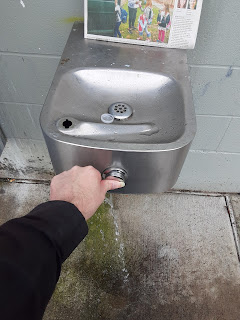
And I'm glad I did, because it turns out Soundview Playfield's water fountain can actually run while the pool isn't in operation; I'd been wrong about that all along.


Green Lake Park

Nothing new here, either.  The Bathhouse Theatre building restrooms were open, as they should have been (unlike the two sets above).

So that was my summer adventure.  I'll try to take it earlier next summer, or maybe only when there are no algae to worry about, or something.

I hope to check the rest of the park restrooms before winter, but I'm not making any promises.  That said, October isn't far away, and my public libraries spreadsheet did survive the crash, so it'll soon be time for, and I can deliver, another round of library hours pages.  One way or another, anyway, happy days and nights, dear Diary, until we meet again.


Monday, April 24, 2023

My February Hikes

Dear Diary,

To start with, I planned to tackle all the parks with restrooms in one region of North Seattle, that is, NE, N and NW, in one day off each.  In reality, on February 19th I visited the majority of NE parks; on February 26, the majority of NW (adding one on the 28th); on March 5 a few in NE and N; on March 12 only Salmon Bay Park; and on March 19 most of N.  (In each region I started in the north, to keep myself from focusing as usual on the closer-together parks further south.)  On March 22 (my day off had switched), I visited the parks of Greenwood and east of there, which were most of what was left, but it was already too late to evaluate their restrooms' winter availability.

In your previous page, dear Diary, I focused on the lists of park restrooms open in winter posted by Christina Hirsch in 2019 and in 2022.  In particular, I noted that of four restrooms or restroom pairs added to the 2022 list in North Seattle, three appeared to be outright lies (University Playground's restroom doors welded shut; Little Brook Park's restroom posted as seasonally closed; Salmon Bay Park's restrooms locked on two visits) and one, at best, a conflict between Seattle Department of Parks and Recreation management and the parks maintenance workers who actually open, clean, do minor repairs on, and close the restrooms, that is, Sandel Playground's restrooms, which now in two winters (2020-2021 and 2022-2023) have been advertised as open but have instead been closed.

However, I found other interesting things on these hikes, including but not limited to more lies, and so plan two other pages to tell you about them, dear Diary.  This is the first, and covers NE and NW.

February 19th

I've now uploaded most of the photos to Google Drive.  For this hike, that means Magnuson Park, Matthews Beach, Little Brook Park, all visited between 1 and 4 pm; then University Playground, Cowen Park, Ravenna Park, Burke-Gilman Playground Park and View Ridge Playfield, between 4 P.M. and 9 P.M.  (The restrooms at Burke-Gilman Playground Park, which I reached at 7:20 P.M., both had visible seasonal closure notices still up; those at View Ridge Playfield, which I reached at 8:04 P.M., stay open all the time, 24/7.  For which I was very grateful by that time, because all the other open restrooms - Magnuson Park's beach restrooms and Matthews Beach's - had been early in the hike.)

I found the street-style fountain near the intersection of the Burke-Gilman Trail and 30th Ave NE not running.  I didn't check the park-style fountain further south.

Other notes:

Magnuson Park

As the previous page noted, without going out of my way re water fountains, I found four that were running, of which three were attached to heated buildings.  The fourth was in Magnuson Park.  It was running strongly:


I was concerned enough about this - cold weather was then forecast - to write to Rachel Schulkin, PR at the parks department.  But I thought there was a real chance that someone in charge at Magnuson Park was doing a controlled experiment, comparing an attached fountain with a free-standing one.  So I told her the fountains should be turned off unless they represented such an experiment.

I think I was worrying too much.  I've told you before, dear Diary, that while homeless I began tracking low temperatures in spreadsheets - a succession of these as the electronic gadgets where I kept them broke or were stolen.  (And as my standards changed.  I originally just listed temperature readings from signs I passed on my way to campus.)  The surviving version goes back to 2019, and I still go to some trouble to keep that spreadsheet up.

Now, 2022 was distinctive compared to the other years I still have, and as best I remember going further back.  I track three thermometers:  one at the roof of the UW's Atmospheric Sciences building, measured every minute by UW personnel; one at Boeing Field, measured every five minutes by the National Weather Service; and one at NOAA's building on the UW campus, a couple blocks south of the Atmospheric Sciences building and much closer to the water, measured every hour also by the National Weather Service.  Historically, my comments on the spreadsheet concerned almost only missed readings at one or another of these.  UW was usually the highest, NOAA often the lowest.  But in 2022, NOAA's readings started going haywire, very often dropping by 8º Fahrenheit for a single reading, sometimes two or three times in 24 hours.  I noted these but only recorded more believable lows.  My complaints about NOAA's readings got ever more baroque as these "swoops" became more frequent and more extreme (for a time they were consistently 11º F in extent).  Finally October 1st to 6th, neither NOAA nor UW gave credible readings; readings at both ranged 11º to 15º F throughout those days.  From October 7th to November 23rd, NOAA was credible, the UW not; but on November 24th, NOAA swooped eight times, and this pattern of frequent swoops making it un-useable as a data source has been its pattern basically ever since, except for a few weeks around New Year's.  On November 28th, the UW came back, and has been steady ever since.  I've since learnt, from my work on the counties, that actually the Weather Service has multiple stations whose temperature readings regularly swoop; I suspect the main brand of thermometer NWS relies on is maybe not up to being used outside for years on end.

Anyway, though, this melange of sources reported a bunch of temperatures in the 20s before February 19 of this year.  November 9th, 2022:  NOAA 29º (Boeing 30º).  November 18th through 20th (both NOAA and Boeing).  December 1st and 2nd, also the 15th and 16th (all Boeing; UW higher).  December 21st through 24th (both UW and Boeing, and going down to 16º).  January 30th, 2023 (both UW, at 29º, and Boeing, at 21º).  So when I found that fountain running on February 19th, one of two things had to be true:  Either it was equal to 16º temperatures, or it was being closely supervised by someone able and willing to turn it off when such temperatures threatened.

So I shouldn't have worried so much.  It looks like Seattle parks could have a lot more running water fountains in typical Seattle winters, although if the explanation is close supervision, that probably doesn't scale up too well.

I didn't find the showers at either Magnuson or Matthews beaches running.

Ravenna Park

Both the 2019 list and the 2022 list said Ravenna Park's lower restrooms were open.  I know from when you began, dear Diary, that the 2019 list was telling the truth.  The 2022 list was not, and I can't imagine why a list that had clearly been actively compiled included the long-term-closed restrooms at Ravenna Park.


February 26th

Again, most of the photos are now at Google Drive, including Carkeek Park, Golden Gardens Park, Soundview Playfield, Loyal Heights Community Center, Salmon Bay Park, Ballard Community Center, Ballard Commons, and also the street water fountain at Greenwood Ave and 85th St, which was near a place where I changed buses, and which I found running very strongly:


Carkeek Park

Carkeek Park is distinctive among the parks of North Seattle with regard to its restrooms:  It's the largest park with only one restroom location.  Jackson Park, the next largest, has only one location for restrooms whose doors open to the outside, and all its restrooms are in one small part of the park, but most of the park is a golf course, which apparently makes that OK.  Otherwise, the next smaller park with only one set of restrooms is Maple Leaf Reservoir Park, one-seventh the size of Carkeek Park.

The reason Carkeek Park can get away with having so few restrooms is partly that most of what's interesting in that park is near those restrooms - the beach, the playground, the picnic shelters.  It's also partly that, like Jackson Park, it used to have park restrooms whose doors open indoors.  But then the Environmental Learning Center at Carkeek Park, which is way off at the other end of the park, much closer to city streets, closed to the public, leaving Carkeek with only one set of restrooms.

So what's new is that one of the ELC buildings has re-opened to the public:


In 2010 it was open Tuesdays through Saturdays, but 10 A.M. to 4 P.M.  So the current schedule is nearly as many hours, though, as in many libraries, it's managed this largely by expanding morning hours.

The front of this building has a lot of glass:


Through this I could see the doors of the restrooms, and could also see a couple of people working.  But they weren't formally open, and I didn't want to bother them (partly because, after all, I hoped to finish NW that day).

Golden Gardens Park

I vaguely remember that the showers here were running, unlike those at Matthews Beach and Magnuson Park.  But my photos don't document this, and it could be a false memory.

February 28th

Gilman Playground

As with Burke-Gilman Playground Park, I got here outside my usual hours limits (6:06 P.M.), but it was OK because there were still closure signs on the doors.  At Google Drive see here.

All for now, dear Diary.  I'll write up the March hikes in the coming days as my schedule allows.  Until then, happy nights and days.


Saturday, December 18, 2021

Magnuson Park Restrooms: A Relative Chronology, part III

Dear Diary,

A couple of days ago I took a few hours off work to go to UW's Suzzallo Library.  My main goals there had to do with the downtown parks, but I also took the chance to look at the biggest final environmental impact statement ever published for Magnuson Park, which appeared in 2002.  Once the libraries re-open next year, anyone interested can find it at F899.S47 W3743; there's also a copy at the Seattle Public Library's Central Library's Seattle Room, which is now open by appointment.  The statement is in two physical volumes, volume 1 and volumes 2-3.  Volume 1 is the main text, the other volume including longer parts that didn't fit, including the comments on the draft report, at which I didn't look more than cursorily, because they're rather compressedly presented.

To recap, the previous two parts used notionally four maps to present a chronology. The environmental impact statement from before the park opened in 1976 spoke of these restroom buildings:

  • The officers' bathhouse (already existing)
  • The enlisted men's bathhouse (already existing)
  • The boat launch restrooms (planned)

The Seattle Department of Parks and Recreation's official picnic map for Magnuson Park confirms (yes, still today) the continued existence of all of these, but also shows:

  • Restrooms near the 74th St park entrance

A mysterious map that used to be attached to a counter at the current beach restrooms there confirmed the continued existence of three of those, but also showed four new restroom sites, one replacing the enlisted men's bathhouse:

  • Tower restrooms (the replacement, still existing but not open)
  • Central restrooms (still existing)
  • Promontory Point restrooms (not existing and possibly never existed)
  • Field restrooms (not existing and possibly never existed)

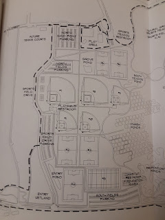
The statement from 2002 is clearly later than these, just as the fourth map I cited, from circa 2012, is.  And it mentions almost the same restrooms as the 2012 map, as two restrooms left over from the military site that preceded the park (Tower and officers' bathhouse) plus the central restrooms.  Here's the map in it that shows restrooms.


Weirdly, it doesn't show any of the restrooms that existed in 2002.  What this map shows is the planned restrooms:

  • Playfield restrooms, more or less where the previous map showed field ones.
  • Sports meadow restrooms, a fair way east of the previous two maps' park entrance restrooms.
  • Promontory Point restrooms, hard to place in relation to the previous map's set.

So if the boat launch restrooms shown on all three earlier maps, and the park entrance restrooms shown on two of them, ever actually existed, they were gone long enough ago by 2002 that the authors of the later EIS didn't feel the need to mention them.  Ditto the Promontory Point and field restrooms shown on the mystery map, whose existence has always been in doubt.  I found nothing, in an admittely fast reading, suggesting that the authors of the 2002 report were aware that each of their proposals would've replaced a previously mapped set of restrooms.

So the question I'm left with is, have restrooms at Magnuson Park actually been thrown away, or have only promises of restrooms at Magnuson Park been thrown away?  If the latter, why so many promises, on so many different maps?  What's so special about Magnuson Park, that either restrooms get torn down there, or restrooms that were never built are shamelessly mapped there?  Why can't the parks department just admit that Magnuson is a big enough park to need more than two sets of restrooms, plan some, and build them, as it would anywhere else?

Anyway, since 2002 the only change is the replacement of the officers' bathhouse with the present beach restroom building.  Also, I still don't know at what date the restrooms at the Brig that have outside doors acquired those doors.

I have to go run errands today, dear Diary, but hope to write the second page about the parks of central downtown tonight.  Until then, happy hours.


Thursday, October 28, 2021

Magnuson Park Restrooms: A Relative Chronology, part II

Dear Diary,

Last night I told you about four locations in which Warren G. Magnuson Park, formerly Sand Point Park, has had restrooms with, so I presume but do not know, doors that open to the outside.  I also told you that I think there've been nine such locations.  It follows that there are five left for today.  I also told you I was using four maps, two of which were the ones you, dear Diary, have been familiar with since your early days.  Neither of those were among the maps I showed you yesterday; it follows that both of today's maps are familiar ones.

Map #3, not yet dated

This map is distinctive in two ways:  It shows Magnuson Park with far more restrooms at once than any other map I've found, almost enough for the giant park - and it's the least discernibly official map.  It doesn't have a Seattle Department of Parks and Recreation logo on it, and I've only found it in the form of a copy taped to the half of the beach restroom building that isn't open to the public.  And on my most recent visit, last Saturday, that copy had finally been torn down, whether by a parks employee or by a thief:


So I have to work from the photos I already showed you, dear Diary, which split the map into two:


So the thing is, this map could originally have been meant to present a vision for the park's future, a vision in which restrooms figure more prominently than in most such I've seen.  It doesn't present anything obviously speculative, and of the seven restroom buildings it shows, three are confirmed by the maps I've already shown you, dear Diary, while two more are confirmed because they're still standing today.  So the issue of this map's trustworthiness boils down, for my purposes, to two buildings.

Anyway, let's look at the restrooms this map depicts.

This is the final appearance of the boat launch restrooms and the park entrance restrooms.  Of the older restroom locations in Magnuson Park, only the beach still has a set, and they aren't the set present whenever this map was made.

Here are the two locations whose restroom buildings still stand:

The Central Restrooms

The parks department calls this pair the "sport" restrooms, but we'll see that this map presents, and other evidence supports, another sport-area pair.  These could be called the "tennis court" restrooms, I suppose, but they're also close to the wetlands, and various other places.  I think it's easiest just to call them central.

This set are seasonal, closing each long winter.  The parks department closes seasonal restrooms for two main reasons.  Some are simply not equal to the weather's demands.  This isn't a bright line - it depends on the weather - but I have a list of restrooms that usually fall on the wrong side of the blurry line, and these aren't on it.  The other reason the parks department closes seasonal restrooms is "historic low usage".  Basically, closing restrooms few people use enables parks maintenance people to spend time on other things in winter, most notably removing graffiti.  Much of my anger last winter was focused on the idiocy of closing restrooms based on "historic low usage" when we were in the middle of a period of historically high usage of park restrooms, but that's more or less water under the bridge now, with all libraries back open, and maybe, somewhere, a community center or two, and ...  More on this in the next supporting page before I get to thrown away amenities as a central topic.

Anyhow, my point is, that these restrooms set into a hill are not closed because they were poorly constructed, but because of parks department manpower allocation, and, doubtless the case with their being closed so early this year, because of vandalism.

The first parks department employee I talked with at length, on my first visit to Northacres Park, had quite a lot to say about vandalism.  I've expressed some scepticism about some cases of vandalism, primarily with regard to water fountains, but I very much doubt he was lying to me in talking about maltreatment of restrooms.  He itemised specific problems that were keeping Cowen Park's and University Playground's restrooms closed (although another parks employee I talked with later gave a very different reason for the latter).

And he really focused on Magnuson Park.  Now this guy has a different take on vandalism from mine.  He joked about the death penalty for taggers; in his view, graffiti can make a restroom unuseable.  But he also told me that he had personally dealt with the aftermath when someone or ones exploded a rabbit in the beach women's room at Magnuson Park, and we'll get back to this topic below.  I don't know why the central restrooms at Magnuson Park are closed, a month before they'd be closed anyway; vandalism is just an easy guess.  But it's quite another story with the next set.

The "Tower" Restrooms

A page in which the parks department talks about future work at Magnuson Park, apparently meant to include resurrecting either the park entrance restrooms or a pair described below, includes a very helpful sentence about this restroom building:  It used to be the Navy's Building 315, and the fire that ruined but did not destroy it was in 2016.  As a result, it's on the last map below, which was made in 2012.

That fire is consistently called "arson", but I've never heard that it was intended for pecuniary gain, or the work of a firebug; what I've heard is more consistent with the work of vandals.

It's a very weirdly built building to be turned into public restrooms, and I think the reason that was done is pretty obvious:  It was handy to the site of the enlisted men's bathhouse, just across the road, so when the parks department gave up on that building, they used this one as a substitute.

I want you to take special note of that, dear Diary:  At one time, the parks department thought it important to replace restroom buildings.  It would be easy to speculate that that 2016 fire was decisive in changing their approach, but in the coming pages we'll see that that isn't so.

Anyway, those are the two buildings still standing.  What of the two that Brian Judd, Magnuson Park's manager, in talking with me, dismissed as fairy tales?

?? The Promontory Point Restrooms

It might be truer to say that these were the parking lot restrooms, or to call them southeastern, but as long as I'm trying to glamourise these pedestrian demolished buildings, I might as well go whole hog.

Of the seven restroom locations shown on map #3, this is the least documented.  All I can go by is that at the place shown on the map, without a "sanican" on top (it's a stone's throw away instead), there's a similar patch of ground to those where the boat launch restrooms used to be, and where the next ones were.  Which isn't much; I'm sure ground can be stunted in other ways.

If these restrooms existed, they may be the easiest to explain the demolition of; they're pretty much in, not just close to, the federally protected wetlands.

Here's the ground I'm talking about:


? The Field Restrooms

Another sign of the untrustworthiness of map #3 is that it contradicts itself as to where these restrooms were.  It shows them facing the southern wing of building 224, which is obviously the building now Santos Place.  But it also shows them well north of home plate on the adjacent baseball field.  Um, these are not the same places.

The problem for people who'd deny that I should trust map #3 at all is that there was definitely plumbing in this remote location.

See, when I wrote your page, dear Diary, titled "Two Magnuson Park Questions Tentatively Answered", the two questions were:  1) Are there any hand-washing stations in Magnuson Park, where half the parks department's "sanican"s in North Seattle are?  And 2) had I already found all the water fountains there?  I answered these questions, in that page, "No", and "Yes".

But as to question 2, I was wrong.  Look:


See that pipe sticking up, there?  That used to be a water fountain.  And it isn't north of home plate.

Going north about as far as I think makes sense gets us this:


But going south of the fountain - completely ignoring the map as regards home plate, but obeying it as regards Santos Place - we get some familiar stunted land:


I'm pretty convinced by the southern location, and although I certainly don't think I've proven my case, I do retract my claim that these restrooms must have been obliterated by the building of Sports Field Drive.  But I also think they came down because the water to this location probably was cut off by that construction, and we know from the Green Lake Community Center last winter that keeping restrooms open without water is asking for trouble.

Map #4, 2012

This is the map writ large near the 74th St entrance to the park, much nearer, in fact, than the site whose restrooms I call the "park entrance" restrooms.  Here's another photo of it:


The reason I date it to 2012 is that a map very like it is in the 2012 "Strategic Development Plan" for Magnuson Park.  Oh, the two versions may differ by a year or three, but they're similar in essentials.

For one thing, unlike the earlier maps, these show "sanican"s all over the park.  One of the comments in the final version of the 1974-1976 environmental impact statement deplored the parks department's intention to use "chemical toilets" for any length of time, strongly preferring real restrooms.  That comment came from a community group.  How times change.

Also, both show only three restroom locations:  central, beach, and tower.  Boat launch, Promontory point, field, and park entrance restrooms are all gone.

Anyone keeping track might justifiably feel confused by now.  I told you, dear Diary, that I thought at least nine buildings in Magnuson Park had contained public restrooms whose doors opened to the outside.  In saying that, I'm actually taking things for granted - after all, I don't even know that the tower restrooms' doors opened to the outside, and I certainly don't know that there was, for example, more than one restroom at the boat launch.  But anyway, so far, I've only told you about eight of those buildings, and here I am out of maps.

The Brig

It would seem that existing outside doors to restrooms within the Brig either were built after 2012, or have never been taken all that seriously by the parks department, as witness the failure to open them when most of the buildings in the park, which had offered their visitors restrooms, had closed.

I don't actually know that there are restrooms behind those doors, never having seen them for myself, but people I've spoken with at the Brig's entrances have told me they're restrooms, and so does the parks department itself.

And a good thing too.  The Magnuson Community Center is undergoing renovation, and its temporary home is in the Brig.  Yet this is what I found on the building's door Saturday:


You'd think we were still in spring 2020.

All for tonight, dear Diary.  Sometime soon I hope to tell you about another focal area of park restroom closure and demolition, one outside North Seattle, but I have more hiking, and more of my own life away from you, dear Diary, to do before that happens.  Good night and good days until then.


Wednesday, October 27, 2021

Magnuson Park Restrooms: A Relative Chronology, part I

Dear Diary,

This is the first of four pages in you that I intend to write to back up my claim, in a not-so-recent mayoral debate, that Seattle too often "throws away" its public amenities.  I intend to spend two pages on that central topic, and two pages on relevant background.  This page is one of that latter pair, and is getting big enough and time-consuming enough to write that I have to split it into its own pair of pages, too.

When I've written about Magnuson Park before, I've relied heavily on two maps I found early in my explorations of the park.  These maps have left me with more questions than answers.  I contacted Rachel Schulkin, communications manager for the Seattle Department of Parks and Recreation, who put me in touch with Brian Judd, park manager.  When he and I talked, I eventually asked him how long he'd been familiar with Magnuson Park, and when he named the year, told him I was pretty sure what I was asking about was before that.  Not long after, he hung up on me.  Well, dear Diary, maybe some people who'll read this page would've hung up on me too, maybe I would my own self, but even though Magnuson is quite a young park, it does have some history beyond the present century.

Now I have what, if you sort of squint, you could call four maps, and some of my questions have been more or less answered.  I'm now pretty certain that at least seven buildings in Magnuson Park, of which four are now standing, have included public restrooms, probably with doors that open to the outdoors.  I therefore think the less official-looking of the maps I was familiar with was probably correct in asserting the previous existence of two more buildings, and have found corroborating evidence for one of those.

In a nutshell, then, Magnuson Park is by far the most important example in North Seattle of the throwing away of park restroom buildings, and that's why proving that, constructing the relative chronology the four maps allow, is central to the view my debate question expressed.

Map #1, 1974

Most maps of Magnuson Park don't bother to indicate the restrooms.  There's a map I looked at tonight at Central Library, also available from the Northeast branch, that doesn't, for example.  But a few of the maps in the Environmental Impact Statement for the original creation of Sand Point Park from Sand Point Naval Air Station - draft 1974, final 1976 - do show them.

I think the final version, which I looked at at Suzzallo Library in late September, in fact the day I was first pitched the job I'm currently working at, shows all three relevant buildings on one map.  However, that version isn't available online, I can't currently get back to Suzzallo, the Seattle Public Library's copy requires pre-arrangements to consult, and in the draft version available online, those buildings are only shown on two separate maps, and two of the buildings are only named in a text page before them.  Here those pages are:


The first map shows two structures near the shore.  I presume these are the officers' bathhouse and the enlisted men's bathhouse mentioned in the page of text, both of which are given short-term park jobs in that page.  The second map has a location labelled "Restrooms".

The Officers' Bathhouse

The Beach Restroom Building

The present building looks old, and may be the building the park inherited as the officers' bathhouse, or it may have been designed in a retro style; I don't know.  I very much doubt the interior is much as it was in 1974.  Note that not all of the building is open to the public.  The most useful document I've had access to on the history of Magnuson Park in general, its "Strategic Development Plan" from 2012, appears to settle the question of the present building's age:  it says page 4 that the "Swim Beach Comfort Station" was built in 2010 for $1,100,000, while on page 21 it says that the "Bath House" built in 1941-1952 was demolished in 2009.  This strongly suggests the story, but I'm still not quite sure, because the bathhouse demolished in 2009 isn't better identified.

Photos of what I considered the "best faces" of the surviving restroom buildings at Magnuson Park can be found in your page "Hike 2B ... main page", dear Diary.  I didn't try to better those photos on Saturday's hike.  Google Images didn't turn up images using the search ' "Sand Point" "Officers' Bathhouse" ' nor with a space in Bath House, but I assume photos exist somewhere.

The Enlisted Men's Bathhouse

This is shown on this map and the next, and then not on the remaining two; it was the first restroom building known to me to go; if it was built during World War II, it may not have been very well built, so no great surprise.  The text page posted above mentions that it was intended to become an administration building, but it's identified as offering restrooms on the next map.  Again, no luck at Google Images, and I'm certainly not going to search for the presumably less photogenic buildings ahead.

Here's what's there now:


The Boat Launch Restrooms

These restrooms are on three of my current maps, including the one I followed in "Magnuson Park: Things We've Lost", one of your first pages, dear Diary.  I speculated there that they were too close to the federally protected wetlands to last, but having re-visited the site Saturday, I don't buy it:  they're just north of vast parking lots, there are currently three "sanican"s there...  Anyway, here's another picture showing what one might expect of land that had had restrooms on top of it for decades, though the presence of "sanican"s, also probably for decades, can't have helped:


Map #2, not yet dated

The official picnic map of Magnuson Park offered by the parks department to this very day is, astonishingly, the second-oldest map I've found.  Given what else I know, it must date back to the 1970s or 1980s.  It's the map that confirms that the enlisted men's bathhouse offered restrooms, that the restrooms projected at the boat launch in map #1 were actually built, and that the next restrooms built at Magnuson Park were those serving the playground and the dogs' off-leash area.


This map was the key to the chronology, in fact.  I'd mis-remembered the location of shelter #1, so I thought this map had erred by omitting the central restrooms, putting the tower restrooms on the wrong side of the shore road, and putting the shelter wrong ... and then finally noticed that it erred in no way at all if I put it into the right chronological place (and got my head out of the sand about that shelter).

The Park Entrance Restrooms

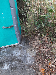
These are only on this map and the next one.  Today part of the area suggested by this map is occupied by one "sanican", at some distance from the others serving the playground; under that object, the concrete is patched, but then, concrete in parking lots often is.  The other part is occupied by a lot of bushy vegetation, offering a gap in the trees thereabouts.  Basically, if the picnic map didn't confirm these restrooms' existence, I couldn't make much of a case based on the surviving topography.


I have no clue at all why those restrooms came down.

That's all I have time to write tonight, dear Diary.  Tomorrow I'll try to finish the story.  Good night.


Saturday, October 23, 2021

Magnuson Park Today

Dear Diary,

I spent several hours in Magnuson Park today.  This was mostly for upcoming pages, which still need other work, but partly also the beginning of whatever I'll be able to do by way of a final water fountain and restroom hike of North Seattle before most of the former and some of the latter get closed for winter, in other words, the meat-and-potatoes work of door shots and such that so many of your pages, dear Diary, consist of.

So of the four sites I track at the Google Drive folder for Magnuson Park, here's the rundown:

Entrance - Restroom doors closed.  These are only supposed to be open in summer, and I haven't visited Magnuson Park for you during summer, dear Diary, so I suppose this is unsurprising.  However, considering that these restrooms are inside the "Brig", and I found this on a door to the Brig itself today:


it is still beyond me to explain why those doors haven't been open daily from the pandemic's beginning to this very day.  Did someone brightly design them to open into the building as well, so hygiene within requires the outer doors to remain closed?

However, in other news, the water fountain near the playground was running.  This is the first time I've found it running since you began, dear Diary.  Its drain was clogged, probably by sand, so I'm not going to show you the dispiriting photo, but still, this is good news.  (That photo, all those in this page, and more, are, of course, in the Google Drive folder.)  Good news, yes, but there are trade-offs ahead.

Central - The water fountain was also running, not that that's a huge surprise any more.  However, the restrooms were all closed.  I found what's either a second door to the women's room, or a separate women's room from the one I'd known about before, around the corner from the doorways already familiar to me.  There was very little explanation of the closure - only the women's room, as usual, still had the closure sign with four boxes to check, only none were checked.  The door I hadn't noticed before, or else had forgotten before ever telling you about it, dear Diary, had a slightly more informative sign about "emergency repairs":


There's worse to come, though.

Beach - The restrooms were as usual - little privacy (as I remembered unhappily when, later on, I needed to use them), no working dryer in the men's room, but the kind of soap the Department of Parks and Recreation was supplying at the start of the pandemic, not the rather worse kind they'd switched to sometime last fall - so only that last was a mild surprise, and a good one.  Outside, the showers were running, though I didn't try to take a photo this time.  However, the water fountain - the attached water fountain, attached to a building with a furnace, which in a better world would run all winter - well, I've recently shown my own ineptitude at diagnosing damage to water fountains, but the spout and the drainpipe are both missing, so the obvious explanation, I think, is metal thievery.


Tower - Nothing meaningful had changed at this closed, closed, closed site.

So for drinking water, visitors to Magnuson Park today had as their best option the central water fountain, but could also brave the playground one; but for a sink, only the beach restrooms were available.  That's also where the only flush toilets were available, but as always, Magnuson Park has plenty of the other kind.

This is the biggest park in North Seattle.  One of the upcoming pages will, I hope, explain how this gigantic park came to this preposterous pass, but that isn't this page's task; this page is just about telling you what I found today.

I hope to start writing those upcoming pages maybe Tuesday, but it'll depend on the utilities where I live; the Wi-Fi was out this morning, and nobody knows what tomorrow's predicted storm might do to the electricity.  Until we meet again, dear Diary, happy days.