Saturday, December 18, 2021

The Parks of Seattle's Downtown, part IVB: Central (one more place)

Dear Diary,

I have three places to tell you about in this page, and then another "today", or rather "tonight" page to write.  So let's get started.

(City of Seattle) Garden of Remembrance

This is a moderately small part of a block, between 2nd and 3rd Avenues and Union and University Streets, on most of which sits Benaroya Hall, home of the Seattle Symphony.  I figured the garden back of the Symphony, with a name like that, would be dedicated to the victims of the Holocaust, or some such.  Nope.  The most informative site is actually one maintained by the designer, which says it opened in 1998.  And it's dedicated to Washington state's war dead since 1941.  That site also says it has names somewhere, but I didn't spend very long visiting it today, and previously only came by night.  So here's what I found:


It has the big rocks on the left as art, I guess, or maybe their other sides are where the names are.  The smaller, carved stones on the right are, I presume, seating, more generous than the similar rocks along Bell St but similarly sacrificing comfort in the cause of preventing homeless people from becoming comfortable.


Carefully constrained parts of it do have plants, although "Garden" is obviously a misleading name for it.


It won more points from me for this fountain, still operating in mid-December unlike, for example, those in Seattle Center, than for anything else.

It's one of two public parts of that block, besides the sidewalks.  The other is a Sound Transit Link stop - one of the northern exits from the University Street station is under Benaroya Hall.  I find this hard to reconcile with the quiet symphonic music sometimes needs, but I suppose somehow or other they must have solved the problems.

(City of Seattle) Benaroya Hall

Yes, the city owns the whole block.  The Seattle Symphony just leases it.  Now, mind you, I just lease the room in which I'm writing this, and I wouldn't expect my landlord to come barging in.  So it's not reasonable to expect the public to have access to this building just because its landlord is the city.

But for some reason, the management of Benaroya Hall decided it was necessary to say this:


Which makes it very odd that last night, half an hour before a concert, I found this:


This is something a forthcoming page will go into more detail about.  Benaroya Hall is across the street from the US Postal Service's downtown post office, which is where I picked up my mail for most of the eight and a half years I was homeless.  It never occurred to me that the building across the street from there might let me in to use their restrooms, and if I hadn't found that puzzling sign, I wouldn't have worried about it.  But other places that have been advertised as offering their restrooms to the public are doing the same thing Benaroya Hall is doing, offering them only to the paying members thereof, and this was a chance to show you, dear Diary, how that looks.

As it happens, research I did in my album catalogues last spring showed that I'm not the cool listener who focuses on chamber music that I thought I was.  Nope, a solid majority of the classical music albums I've paid to own, well over a hundred of them, are actually symphonic ones.  So I'm not picking on the Symphony out of reverse snobbery.  It was just a strange and striking thing to find.

(Seattle Public Library) Seattle Central Library

As planned, once I'd documented the one place I'd added to my list of central downtown places from Seattle's 2020 real property report, I went back to the Central Library, returned the two things that had motivated the trip downtown today in the first place, and started taking photos to make up for my churlish refusal to do so in the previous visits that went into the previous page.

I got here just as mania for the current library building, which opened in 2004, was dying down, and still heard quite a lot about architect Rem Koolhaas's "cool house", har har har.  Having lived through something similar in Chicago, I've never really caught that particular fad, and in particular I don't think the outside of the library is all that prepossessing.  But in case any of your readers disagree, I photographed the part of that outside that works best for me, the 4th Ave plaza:


Once inside, it dawned on me that the previous page's list of photogenic parts of the library omitted one rather important one:  the awe-inspiring rows of bookshelves themselves.  In particular, the fiction shelves of the open third floor outdo the book spiral's shelves on the closed sixth through ninth floors because they're staggered, so even if my photo isn't very good, good photos can certainly be taken.


On the open fifth floor, I found that a large area where, early in my homelessness, I liked to plug in my laptop (I usually had a laptop, 2012 to 2017), had re-opened.  Most of this area had been taken over each winter for the United Way's free tax return project, and more recently that project had expanded to year-round.  They apparently expect to be back next month, so the rest of this year is essentially people's only chance to experience the part of the fifth floor where one can sit down without signing up for a computer, as it used to be, before competition for the few spots remaining left them fully occupied all day.


The equipment in the foreground belongs to a gentleman who considerately withdrew to let me take this picture.

One of the fifth floor's intended attractions is the chance to watch people move around on the third floor below.  I've never really understood this as an attraction, so hadn't really thought about it much.  But it turns out the ceilings that soar over the fifth floor actually also soar over the third floor, from which I took this photo:


I tried pretty hard to photograph the very weird artwork that's probably my favourite from this library, the parts of faces that say odd things to anyone who goes down the escalator from the fifth to third floors.  Unfortunately, it's a very balky artwork, often losing sound, visual, or both, and so I wasn't surprised to find it not running yet.  Anyway, this is the maugre best of four attempts.


And that's the set of photographs I took, trying to appreciate the Central Library better than I had last time.  I'm sorry most of them aren't all that good.

One more page, and then good night, dear Diary.  For now, good minutes.


Magnuson Park Restrooms: A Relative Chronology, part III

Dear Diary,

A couple of days ago I took a few hours off work to go to UW's Suzzallo Library.  My main goals there had to do with the downtown parks, but I also took the chance to look at the biggest final environmental impact statement ever published for Magnuson Park, which appeared in 2002.  Once the libraries re-open next year, anyone interested can find it at F899.S47 W3743; there's also a copy at the Seattle Public Library's Central Library's Seattle Room, which is now open by appointment.  The statement is in two physical volumes, volume 1 and volumes 2-3.  Volume 1 is the main text, the other volume including longer parts that didn't fit, including the comments on the draft report, at which I didn't look more than cursorily, because they're rather compressedly presented.

To recap, the previous two parts used notionally four maps to present a chronology. The environmental impact statement from before the park opened in 1976 spoke of these restroom buildings:

  • The officers' bathhouse (already existing)
  • The enlisted men's bathhouse (already existing)
  • The boat launch restrooms (planned)

The Seattle Department of Parks and Recreation's official picnic map for Magnuson Park confirms (yes, still today) the continued existence of all of these, but also shows:

  • Restrooms near the 74th St park entrance

A mysterious map that used to be attached to a counter at the current beach restrooms there confirmed the continued existence of three of those, but also showed four new restroom sites, one replacing the enlisted men's bathhouse:

  • Tower restrooms (the replacement, still existing but not open)
  • Central restrooms (still existing)
  • Promontory Point restrooms (not existing and possibly never existed)
  • Field restrooms (not existing and possibly never existed)

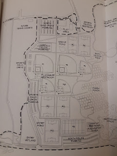
The statement from 2002 is clearly later than these, just as the fourth map I cited, from circa 2012, is.  And it mentions almost the same restrooms as the 2012 map, as two restrooms left over from the military site that preceded the park (Tower and officers' bathhouse) plus the central restrooms.  Here's the map in it that shows restrooms.


Weirdly, it doesn't show any of the restrooms that existed in 2002.  What this map shows is the planned restrooms:

  • Playfield restrooms, more or less where the previous map showed field ones.
  • Sports meadow restrooms, a fair way east of the previous two maps' park entrance restrooms.
  • Promontory Point restrooms, hard to place in relation to the previous map's set.

So if the boat launch restrooms shown on all three earlier maps, and the park entrance restrooms shown on two of them, ever actually existed, they were gone long enough ago by 2002 that the authors of the later EIS didn't feel the need to mention them.  Ditto the Promontory Point and field restrooms shown on the mystery map, whose existence has always been in doubt.  I found nothing, in an admittely fast reading, suggesting that the authors of the 2002 report were aware that each of their proposals would've replaced a previously mapped set of restrooms.

So the question I'm left with is, have restrooms at Magnuson Park actually been thrown away, or have only promises of restrooms at Magnuson Park been thrown away?  If the latter, why so many promises, on so many different maps?  What's so special about Magnuson Park, that either restrooms get torn down there, or restrooms that were never built are shamelessly mapped there?  Why can't the parks department just admit that Magnuson is a big enough park to need more than two sets of restrooms, plan some, and build them, as it would anywhere else?

Anyway, since 2002 the only change is the replacement of the officers' bathhouse with the present beach restroom building.  Also, I still don't know at what date the restrooms at the Brig that have outside doors acquired those doors.

I have to go run errands today, dear Diary, but hope to write the second page about the parks of central downtown tonight.  Until then, happy hours.


Monday, December 13, 2021

The Parks of Downtown Seattle, part VIB: North-Central (the biggest places)

Dear Diary,

Whew, one more page and I'll be done with today's hikes.  And this one is easy to write, too, it's just photo-heavy.

Only one Seattle Department of Parks and Recreation park in north-central downtown Seattle is bigger than an acre, big enough that it figured in my earliest plans for this series.  It is, however, a joke of a park.

Bell Street Park Boulevard

That's the name the 2020 real property report gives this "park".  The name at the parks department website is less incongruous, though not less misleading:  just Bell Street Park.

What this "park" actually is, is four blocks of Bell St (1st to 5th Avenues), one-way and single-lane as regards traffic, making room for roughly seven islands of plantings and interesting pavement per block, four on one side, three on the other.  (Hence it isn't really a "boulevard".)  Or maybe they're less regular than that; I didn't count every block.  These islands are highly similar.

So following my procedure with Ravenna Boulevard, one photo per island, was out of the question.  Not only would this result in more photos than Blogspot was likely to tolerate on a page, it would result in more boredom than I'm likely to tolerate on a hike.  Some other boulevards I haven't told you about yet, dear Diary, separate neatly, one island per block, and I figured one photo per block was a reasonable choice.


This is a view of the "park"'s start, from across 1st Ave.


This is a close-up of one of the islands between 2nd and 3rd Avenues.


This is an uneasy juxtaposition of public seating (those rocks are really the only seating the city dares provide here, for fear of homeless people) and private table.  I told you this would come up again, dear Diary, and watch for it below too.


That in the foreground is signage from Bell St's time as a "Stay Healthy" street.  As in Golden Gardens Park, so in "Bell Street Park", it was just too essential to resume letting people drive through.

The biggest park in Belltown is, obviously, a pretty cynical comment on the parade of parks in the previous page.

Now for a horse of a very different colour:

Seattle Center

For most of 2020, dear Diary, I expected your last series to be on the UW campus, one way of understanding which is as a collection of park-like spaces.  And in December I hiked a lot of parts of the campus with which I'd been unfamiliar, as well as some I'd known better, and took lots of photos, which is one reason I had limited storage space for photos on my phone thereafter.  The UW campus existed before then, but its landscaping - including many of its park-like spaces - originated from the 1909 Alaska-Yukon-Pacific Exposition, which wasn't a classic World's Fair, but was a similar sort of endeavour.

So Seattle Center, once I seriously looked at it for this series, was easiest to understand as the creation of the 1962 Century 21 Exposition, which was a classic World's Fair.

Each is a large public space focused on many buildings, where those buildings are grouped in park-like settings.

However, beyond that, they differ significantly.  UW is focused on providing post-free education.  It takes serious money to attend UW.  As a result, it's a serious place.  It only names some of its parkish areas, often the smaller ones, and if an educational need calls for a new building, it doesn't hesitate to sacrifice some of them.

Seattle Center, on the other hand, while serious enough for the host of people who work there, is primarily in the business of entertainment, understood very broadly - everything from sports to music to TV, and, yes, museums.  From the classical music and theatre as well as the museums comes one of the educational institutions there, the Center School (an "arts-focused" honest-to-God Seattle Public School); from the sports, perhaps, the other, the schools' Athletic Department.  Similarly, KCTS brings in Crosscut, where my former editor Mark Baumgarten works.  And I'm sure there are other things that aren't obviously entertaining.  But the centre of Seattle Center is entertainment.

As a result, being essentially less serious by current standards, they take their park-like spaces much more seriously.  They name them all, and naming makes it harder to abandon them to building mania as at UW.  They also do something typically parkish that UW doesn't do, but that I'm not letting myself discuss in this particular series.

This makes Seattle Center's 74 acres (like UW's 634) an interesting contrast with the parks of the Seattle Department of Parks and Recreation.  Seattle Center is a whole separate city department, and it has a very different ethos.  (It's drenched in advertising, for one thing.  Imagine that in the real parks.)  I don't know how much landscaping help they might get in the real world from the parks department, but the results don't look much like the parks department's work.  On the other hand, both city departments are departments of the city of Seattle, so they share some perhaps-expected priorities.

In today's one-hour hike meant to get me to overcome my fear of Seattle Center, for example, I found two significant woods in the place.  One is meant to separate their main park, the International Fountain Mall, from Memorial Stadium.  It's divided by walls, by a promenade, by electrical lines; I couldn't begin to approach most of it.  The other woods, though smaller, is all in one place, and even has trails.  This is the Theater Commons, and in it, signs earnestly explain that it's not just a woods, which is good enough reason for existing, but it also helps with various environmental concerns.  So that's a Seattle thing.

Helpfully, all over the grounds are electronic kiosks that present the standard Seattle Center map with the main outdoor attractions highlighted in a green much brighter than most of the other colours in the map.  I cheated, and although I did hike each east-west street, essentially my entire photo-taking trip took only an hour and a half, thanks mainly to this map.


The Theater Commons was actually the last place I visited, as witness the photo's darkness.  The first main area I photographed was the Mural Amphitheater:


Then I went to the Broad Street Green, which is by far Seattle Center's most outward-facing park-ish place, and which is the clear winner for ostentatious public art among the downtown parks because it cheats.


How many other downtown parks have room for architecture, even phallic architecture?

Next the South Fountain Lawn, which delivers truth in advertising:


Inevitably, the one photo my umbrella messed up was of their main and most popular park, the only one I found crowded on a rainy December Sunday afternoon, the International Fountain Mall.


This is meant to have a fountain in the middle, and to be a promenade.  But all the fountains I found were at least off (one removed for renovation), and the promenade is only for serious promenaders, mostly children with their parents, because it can only be entered or exited for a quarter of its circumference.

Artists at Play is meant to be artists' idea of a playground.  Turns out only two artists were involved, and it's not a huge playground, but it's pretty darn big, far outshining other playgrounds known to me downtown.  (In fact, Seattle Center treats Artists at Play as one of its properties in the real property report, and says it's over 3 acres.  That's a typical size for the North Seattle parks called Playgrounds.)


And, um, that's it.  Memorial Stadium is a kind of thing we have in North Seattle, though I'm not sure how parkishly, but I found it buttoned up tight, the only glimpses I got (along a path that it turns out I wasn't allowed to take because I'm not a car) also showed me it was in use.

So those are the large parks Seattle Center fits into its area.  Seattle Center will happily inform anyone curious about smaller gardens, about the fountains that aren't currently running, about the skate plaza I didn't even visit...

One thing I found notable is that Seattle Center really believes in grass.  Well, so does the parks department, but with significantly more landscaping variety.  Also, when I hiked out onto the Broad Street Green to take the photo above, I found it extremely un-drained, and was grateful to be wearing heavy, high shoes.  Now, I've had similar problems in Magnuson and Green Lake Parks, but only when near bodies of water; what body of water is close to Broad St and John St?  So Seattle Center likes grass, but doesn't want it walkable.  (Hence, for example, promenaders on the International Fountain Mall might not want to make their own entrances or exits.)  On the whole, then, I'd have to say, the Seattle Center parks don't represent an alternative to the parks department that much interests me, aren't really a good reason to visit the place, unless, of course, one is a Belltown resident without good alternatives.

When I lived on Capitol Hill, I didn't often visit Seattle Center.  I did often try to, but routinely found that my event's starting time came about halfway through the endless hike along Denny.  I took to seeing the place as a wall around half the interesting things in Seattle.  I've probably visited it more effectively since becoming homeless, because the city makes this most commercial of its departments do charity every so often; the glasses I've worn while writing tonight's pages, I got from a United Way event there.  But only now, living far away, have I finally begun to get a handle on the vast place.  If it's a wall, well, half the interesting things in Seattle are worth scaling a wall for.  So I don't want to condemn the whole place, and hope myself to go to plays there in the future, or listen to KEXP, or ...  All I'm saying is, don't go for the parks.

Not that you'll go anyway, dear Diary.  But if you talk to their website, would you please let them know Firefox is throwing a hissy fit because their https certificate is outdated or something, and they should fix it?  Thanks.

I expect to have another page to write in you, dear Diary, related to but not in this series, sometime this week, or maybe next, and hope devoutly to polish off the legion of northeastern downtown parks this coming weekend.

Until then, good night, what's left of it, and good days.


The Parks of Downtown Seattle, part VIA: North-Central (smaller places)

Dear Diary,

I'm back, and ready to write about the parks of Belltown and about Seattle Center.

In writing the catch-up pages, the last few, I've gotten out of the habit, but since this page and part VII shouldn't need any catch-up pages, I'm going back to writing from smallest to largest.  Since both pages include several private parks and similar things that I haven't found in Seattle's real property reports, this is taking some guesswork on my part.

(City of Seattle) Al Rochester's Podium

This is a small area with benches where 4th Ave meets Denny Way.  More precisely, it's the oddly shaped polygon made by Clay St, 4th Ave in the direction it goes north of Clay, the line 4th Ave follows up to Clay, and Denny.  It's pretty certainly the smallest more or less public, more or less park-like, area I found in north-central downtown Seattle.


Since I remember walking along Denny as consistently exhausting, I can only applaud anything that puts more benches along that street.  I'm also amused by my own reactions to the guy it's named after.


(The plaque, that is, was donated by family members, and for all I know the benches; the land was the city's to start with.)  Al Rochester seems to have been the kind of politician everybody liked, which in my experience means the kind who doesn't get much done, but he also seems to have spearheaded the World's Fair that created Seattle Center.  So what do I know, dear Diary?

(SDOT) Tilikum Place

Tilikum Place is a typical Seattle Department of Transportation downtown park:  a triangle with brick paving, a bus stop, some sculpture.  However, it also has benches, which makes a big difference; people other than commuters want to spend time there, sometimes.  Though maybe not on a rainy Sunday in December:


Oh, and it has trees, which probably provide shade in summer.  Tilikum Place is probably my favourite among the parks of Belltown, not that that's saying much, as we'll see.  It's another of the SDOT parks that has its own Seattle Department of Parks and Recreation web page, and a rather entertaining page it is, too, mainly about this sculpture:


The sculpture doesn't greatly impress me as art, but as an image of an American Indian leader rather than a settler one, I'll take what I can get.

This is one of several parks in this page which I visited on November 21 with a friend, not long after telling you, dear Diary, that I hoped not always to hike alone for you.  It was a very pleasant afternoon, though few photos resulted.

Tilikum Place is also on Denny, between Cedar St, the line Cedar St takes until it reaches that spot, and 5th Ave.

Belltown Community Center


Yes, "No Public Restrooms".  Yes, the particular private business now resident where the 2020 real property report incorrectly claims the city still had a lease had reason to put that sign up.  The Belltown Community Center was promised voters in a 1999 vote, but the resulting money wasn't actually enough to buy real estate in Belltown.  So the parks department gave up and leased a space, which opened in 2012.  The lease ran for seven years, turned out something of a boondoggle, and wasn't renewed after 2018.  So, more or less, says an exceptionally detailed and informative blog post by your old, um, frenemy, dear Diary, Rachel Schulkin, communications manager for the parks department.

I'd imagined it would've gotten a lot of visits from poor people who'd finished their business at the DSHS office nearby, but apparently it actually wasn't popular much at all.  Still, my friend, who is not poor and who lives in Belltown, was as disappointed to see that sign on November 21 as I'd been a week earlier, and it introduces both the series of parks on Bell St (the BCC was at 5th Ave & Bell), and this page's theme.

The private business is a "Dashmart", apparently one of those "dark grocery stores" we kept hearing about early in the pandemic, but this one owned not by a grocery chain (whose workers probably would be unionised) but by the delivery business Doordash (whose workers probably wouldn't be unionised).  Ironically, the people I saw today picking up or dropping off items looked, by and large, about as poor as I'd imagined the users of the Belltown Community Center to be.

(?Port of Seattle) Unnamed parklet

According to the King County Parcel Viewer, the Port owns the building this small space (which I found through Open Street Map) seems to be attached to, which it calls the Viewpoint Building, and in the past called World Trade Center North.  It's basically a paved space between the two buildings that share the block between Elliott Ave, Wall St, Bell St, and the railroad.  It could've been the Battery St Street End, but that's actually on the shoreline one block southwest and down.  It looks like this:


So basically, it has seating (I think) at the far end, a view in the same place, and a basketball hoop.  It's about as good as Belltown parks get, unfortunately.  It has a gate structure, but no actual gate within it.  However, the stack in the distance before the view, in the photo above, includes that gate and a whole bunch of similar panels, and I wouldn't be at all surprised to find this little parklet fenced a year, maybe even a month, from now.

(Private) The Fourth & Blanchard Building's Courtyard

One building in Belltown has a huge front yard, complexly and interestingly landscaped.  It seems to have noticed this space becoming popular with people from outside the building; on all sides, what would seem to have started as entrances have been fairly permanently walled with materials that probably were more or less ready at hand.  Well, all that is the owners' and even the tenants' right.

But one element of that courtyard is a sculpture, and while the woman that sculpture depicts may not be intended as homeless, she's certainly intended as tired:


And it is just rude to taunt that sculpted woman, who has no choice but to rest indefinitely, with a "No Loitering" sign:


Regrade Park

This is the second of the three Bell St parks, occupying a little more than a quarter-acre at the southwest (actually south) corner of 3rd Ave & Bell.  It is the third-biggest parks department park in Belltown.  And...


in 2005 the entire park was turned into the fourth-smallest off-leash area for dogs in Seattle.  All that from this 2017 report, a 194-page PDF, which informed me that there's an organised group in Seattle who take care of most of the existing off-leash areas and push for the creation of more.  Their "biennial report" is the most interesting part of the document, pages 94-114 (going by the numbers on the bottoms of the pages).

As you can see, dear Diary, it's a much more attractive off-leash area than the one I've shown you in Magnuson Park.  It has actual colour.  It has trees.


But I'm pretty sure Regrade Park is a place where dogs, perhaps, can recharge their souls, but people are likely to find that rather more difficult.

Belltown Cottage Park

Quite a few people probably can recharge their souls more or less easily at this next park, the largest real park in Belltown, which is on the southeast (actually east) corner of Elliott Ave and Vine St.  Probably two or three dozen people, total.  For everyone else, soul-recharging takes some rule-following, some consideration, and some luck, at the very least.

This park is split down the middle.  The parks department owns the whole thing, but accounts for it as two properties in the real property report:  "Belltown Cottages" and "Belltown Ppatch", respectively 7,216 and 7,214 square feet.

This was the only place my friend and I reached early enough to photograph on November 21.  In the P-patch half, it's easy to take pictures.  And yes, it's a real P-patch:


It was opened in 1995, and obviously a lot of loving work went into it; notice the beauty given to the stairs up to it:


The Cottage half is rather harder for me to photograph, because unlike Hubbard Homestead, the cottages of Belltown Cottage Park aren't lost to history.  They're actual homes in which actual people live.  There are three, though usually only two at a time are occupied, and they have one small back yard that the general public is supposed to believe (but not really believe) is actually a public park.


I don't know how long they've been specifically the homes of writers in residence at Richard Hugo House, which is on 11th Ave on Capitol Hill, maybe a mile away uphill, but the program goes back to 1999.

I only stopped briefly there today, struck by something I hadn't noticed on previous visits.  Like most P-patches, this one has a fence and a gate:


(City of Seattle) Unnamed possible park

I was ready, today, to declare that Bell St isn't really where the parks of Belltown are, that unofficial private parks on Battery St were the neighbourhood's real gathering places.  But no, the only person I saw at the Port of Seattle parklet was one guy shooting hoops (who kindly backed away long enough for me to photograph the area).  And Seattle doesn't want anyone at all at this next property, which could be Belltown's biggest park.


Yep, another hill.  This one wraps around a parking garage at the corner, which is city-owned; the Parcel Viewer sees the garage as a taxable property, but not this area, but I'd bet it's city-owned too.  As if the fence weren't enough, the city has signs here too:


In case any of your reader don't recognise this kind of sign, dear Diary, it's headlined "No camping in emphasis area".  In other words, while being homeless anywhere in Seattle is essentially illegal, involves trespassing either on private or on public property, "emphasis areas" are places where the city really doesn't want anyone camping.

I can't believe it takes a non-parks department staffer to state the obvious here, but has it occurred to the city that it could build a Belltown Community Center at the top of the hill and a Belltown Playground at the bottom, and deter campers that way?  Instead of just setting up the same tired refrain, "We can't have anything nice because then homeless people would wreck it."  Which is the message communicated by that fence and that sign.

How much of Freeway Park have we wrecked?  How much damage did my sleeping in Kirke Park, Soundview Playfield, Sandel Playground, and Green Lake Park, among others, when hiking for you, dear Diary, do to the enjoyment of housed Seattleites?  I'm particularly irked by the repetition of this meme in Belltown because it isn't the homeless who've taken the parks away from Belltown.

It isn't big companies, either.  One of your themes, dear Diary, all along, has been the public and the private.  The bet on which I started you was that mayor Jenny Durkan was right to say that we homeless should, during the lockdowns, rely on public park restrooms rather than, in my case, the more convenient ones at the private University Village shopping mall.  I wrote a whole page about the difficulty in doing so when private restrooms were reliable and public ones weren't, in your earliest days, and a few weeks later wrote what I then thought was the beginning of your conclusion on the same topic.  It's easy to think that "the private" always has to be business.

But in Belltown, "the private" is neither business, nor inconsiderate homeless campers.  It's gardeners, and it's a writing program, and it's dog keepers.  And it's the scaredy-cats at the City, and perhaps soon at the Port, who put fences around what Belltown needs.

There are two main complaints about homeless campers in parks and for that matter everywhere.  One is that we're scary to many people.  I don't see what homeless people are supposed to do about that.  It's not as though I suddenly turned from a mild-mannered office clerk into an axe murderer when I became homeless, nor is it especially surprising that I'm now again a mild-mannered office clerk.  Actually, I was a mild-mannered office clerk while homeless, working as a tax preparer, submitting suggested changes to library classifications.  It's not my fault that I nevertheless scared people.

But the other complaint about homeless people is more serious.  We take away public geography and turn it private.  There essentially isn't any other way to exist while homeless, that doesn't involve that.

What lesson, then, do the parks of Belltown, where any number of housed people have made public geography private, teach the conscientious homeless man?

In the remaining two places in Seattle's north-central downtown that I intend to tell you about, dear Diary, the issue of public and private comes up again, as it will in northeastern downtown, where there are new and serious private parks.  But I'm used to thinking that Blogspot doesn't want quite so many photos in one page - it certainly didn't when I wrote your pages on my phone - and anyway, the parks I just discussed pose this theme of the public and the private more sharply than the ones remaining in north-central downtown do.  So yet again, I'm splitting this page, and that'll probably happen with part VII too, because there are lots of parks in northeastern downtown Seattle.

Until the next page, then, dear Diary, happy minutes.


Sunday, December 12, 2021

The Parks of Downtown Seattle, part VC: Northwest (two more places)

Dear Diary,

Today I visited the remaining places I didn't reach last weekend, of the nine I'd found by consulting OpenStreetMap, and the 2020 and 2021 Real Property Reports of the City of Seattle, within the parts of downtown I'd already covered in this series of pages.

The other seven, for anyone confused by the previous page, were 1) the Seattle Department of Transportation portion of the Elliott Bay Trail, two more localised SDOT parks - 2) the Washington St Boat Dock and 3) the Habitat Bench on Seattle Waterfront - 4) the Goat Hill P-Patch, 5) the areas that I ended up telling you, dear Diary, about as the other two thirds of Goat Hill, 6) Waterfall Garden Park, and 7) to be named probably next weekend, because I didn't get back there yet to take photos by daylight.

A site from my tax preparation past came to mind all of a sudden as I was dithering over the ownership of many places on Open Street Map:  the King County Parcel Viewer.  So I can now tell you, dear Diary, that King County considers itself the owner of the P-Patch part of Goat Hill and of the tree-dominated area southeast of it (bundling both in with the Goat Hill Parking Garage between them), but expresses no opinion as to the ownership of the grassy area across 6th St from the latter.  My strong impression from looking at other places on the Parcel Viewer is that when King County expresses no opinion like that for land within Seattle, the City of Seattle is usually the owner, and in the two pages I hope to write tonight, I'm going with that assumption.

Anyway.  So I hope to write part IVB, Central (one more place), next weekend, as well as part VII, Northeast, but for now can write parts VC and VI, North-Central.

(City of Seattle) West Mercer Stairs Park

This is Open Street Map's name for a place I'm pretty sure SDOT simply considers an undeveloped street.  There's a part of W Mercer St that runs to a little past 5th Ave W, and there's a part that runs from 6th Ave W to Elliott Way W.  Between those is a steep hill, with a stair on its south side allowing people who can deal with stairs to walk between these two streets.  The rest of the hill, however, looks like this:


It's mildly worth visiting, should one's path bring one to that neighbourhood.  It's a much more impressive solution to the problem posed by that hill than I saw at a private building further south:


(Private) Elliott Bay Office Park

The Seattle Department of Parks and Recreation rented, as of the 2020 report, office space in two more or less downtownish buildings.  I'll get to the other one, which is on the south side of S Dearborn St, in a future series of pages, but this one is well south of W Mercer St.  It's got grass and art in front of it, so it's a reasonably worthy place for the parks department:


But of course since today isn't a weekday, I couldn't go in and find out whether their actual offices face that area, let alone the parks (Myrtle Edwards and Centennial) beyond.

Well, dear Diary, as soon as I've gone and gotten my Sunday hike reward, a meal from the restaurant, O'Ginger Bistro, that helped save my life on a Sunday hike that went grievously wrong last winter while I was still homeless - anyway, as soon as I've done that, I'll start to write page VI of this series, about the parks of Belltown and about Seattle Center.  Until then, a happy hour or two.


Tuesday, December 7, 2021

Park Home Circle Tonight

Dear Diary,

I'm not sure how much good news I'll have for you this week.  I got a surprise tonight.  But there is one piece of good news I can give you right away.

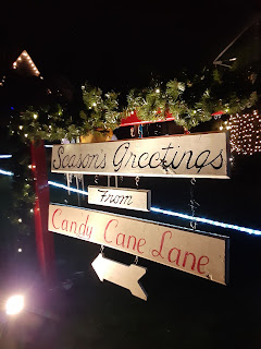
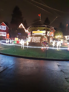
I'd noticed, last December, something funny going on, on the street where Park Home Circle, the 7th-smallest Seattle Department of Parks and Recreation park in North Seattle, is.  But I was still homeless and rather smelly then, and what was going on reminded me too much of my middle-class upbringing to investigate under those circumstances.

Tonight was a different story, so let me show you, dear Diary, how even the 7th-smallest park can bring some joy to some people.


Well, you know me, dear Diary, I do so love to photograph signage.  But I also took a landscape shot:


And even a video:

In other news, I found the water fountains still running tonight at Hing Hay Park - well, small surprise that, a street-style fountain not very far from a building - and, much more surprisingly, at Ravenna Park, the fountain next to the "lower" restrooms.  I even drank from the latter, and found it tasted better than I'd remembered, though both its bowls' drains were blocked by sand.

Happy holidays, dear Diary, and we'll see how much more good news I have for you soon.  Until then, good night and good days.

Sunday, December 5, 2021

The Parks of Seattle's Downtown, part IIIB: Southwest (more parks)

Dear Diary,

Last week through yesterday, I worked on the spreadsheet mentioned in your previous page, but yesterday I got a little more focused on this downtown project.  I'd found that it'll take weeks to get the spreadsheet to where I want it before I publish it at Google Drive, so in the meantime I wanted results I could use sooner.

Meanwhile, the simple fact is that I don't really like the parks of Belltown - the north-central part of downtown Seattle as I've defined those things for these pages, part VI - all that much, which makes it hard to motivate myself to hike to them on the few dry-ish days to photograph them.  I'll try to do that next weekend, weather allowing.  My current temporary job is apparently to continue the rest of this month, so I remain constrained by that.

Still, today, with actual dry weather, I wanted something more challenging and perhaps enjoyable.  My goals for today were to visit all the places the spreadsheet had told me about, which should've been covered in the existing parts of this series, and to trace the Elliott Bay Trail from its southern end to the part I told you about already.  I got to, for some definition of "got to", seven of the nine places, although I'll put off telling you, dear Diary, about one, because it fits into central downtown, and I have an errand at the Central Library soon which I might as well expand into taking some photos.  Today's parks and similar places turn out to be hard to like too.  Three were closed to the public when I visited today, and one probably never fully existed.  But at least they were mostly new to me, and I hope they'll interest you and anyone who reads you.

(Various agencies) The Elliott Bay Trail

Pages around the Web claim that this trail starts at Broad St, or at Lumen Field, which is more or less between S Royal Brougham Way and the line of S Lane St.  The Broad St claim sort of makes sense, as we'll see, but the Lumen Field one doesn't.  A current version of the Seattle Bike Map gets it right.

South of S Atlantic St, Alaskan Way S has bike lanes on each side of the road, physically separated from the traffic only by those flimsy-looking stick-like things.  North of Atlantic, where Alaskan rises and then descends, there's a relatively wide trail separate from the traffic, which doesn't rise and descend.  This trail, like much of the trail between W Garfield St and Smith Cove Park, is sandwiched between fences, although here there's Port of Seattle property on only one side, railroad tracks on the other.  The main reward for taking this part of the trail is the view ahead, of downtown:


The Port is the trail's lead agency, and I assume it owns this segment.  The main thing enlivening it, besides the view, is a series of markers attesting bits of nautical history.

At S King St, this part of the trail emerges on the west side of Alaskan Way S and ends, and another part starts, which is much more like the Burke-Gilman Trail:  no fence, cyclists and walkers separated, the cyclists getting smooth pavement, the walkers regular sidewalk.  There's also some landscaping.  I suspect the part the Seattle Department of Transportation reports owning in the 2020 Real Property Report actually starts here.


At S Main St, the sidewalk, which had been to the trail's east, switches to the west, towards the buildings, and gets much wider, essentially becoming the sidewalk of the popular parts of Seattle's downtown waterfront.

And then two blocks later, at Yesler Way, the sidewalk continues, but the bike trail is just cut off.

It's cut off by construction.  From here all the way to Broad St, the prior existence of the Elliott Bay Trail is not proven by facts now on the ground.  I'm pretty sure, in fact, that from Bell St to Broad St it never did exist, or at best merged with the sidewalk on the west side of Alaskan Way.  But I'll take this segment by segment.

The construction barricades block mostly the west side of Alaskan Way from Yesler to Marion St.  They curve between Marion and Madison St, and then from Madison St to Pine St they block mostly the east side of Alaskan Way.  My hypothesis is that the Elliott Bay Trail did exist before the construction began, and that it crossed the street somewhere between Marion and Madison.  My evidence is pretty scanty.

For the first part, Yesler to Marion, it's mostly the way the trail suddenly stops.  I don't believe it was originally built that way.

Counter-evidence:  Much of the road on the west side of Alaskan between Marion and Madison looks pre-construction in age to me, and shows no trail markings.  So unless the crossing was at or near Marion, there may not have been a trail on that block.

For the second part, Madison to Pine, I have two bits of evidence.  First, the SDOT listing in the Real Property Report gives 1100 Alaskan Way as the address of the part of the trail it owns.  This is Alaskan and Spring St, a block north of Madison.

Second, something that looks a great deal like parts of the Burke-Gilman Trail exists, a few yards from the east side of Alaskan Way, right up against the buildings there, from Pine St to a few yards south of Bell St.  Where it actually does just stop:


I saw no cyclists on this segment tonight, but did see a whole lot of people riding scooters, or whatever those things are called.  There are a couple of directional signs similar to those on the BGT on this segment of whatever-it-is, too.

From Bell to Broad:  I found nothing.  The pavement of the wide sidewalk on the west side of Alaskan there is continuous, much more amenable to cycling than the pavement further south, and I suspect cyclists are meant to cross again, although there were still a lot of pedestrians that far north.  But there are no trail markings and no directional signs on this segment.

What I actually saw half a dozen cyclists leaving the Elliott Bay Trail at Broad St do, though, was take to the streets - most to Alaskan, one to Broad.  I also saw a group of at least half a dozen cyclists heading north on Alaskan in the street.

So although the bike map is right about the trail beginning at Atlantic, it's wrong that it exists continuously from there to Broad.  I seriously doubt it really ever has.

(SDOT) Habitat Bench on Seattle Waterfront

The Port of Seattle has a fence along the trail all the way from Atlantic to S Jackson St; it calls that entire area "Pier 46".  When I showed up too close to the fence at Atlantic, a guy came out to warn me away.  Most addresses south of Jackson are in the 400s S (the Port claims that everything behind that fence, all the way down to Atlantic, is at 401, but OpenStreetMap makes the falsehood of that plain), and most addresses north of Atlantic are in the 1200s S.  So SDOT's property at 601 Alaskan Way S, almost an acre in size, is somewhere behind that fence.  It's meant as "Wildlife/Fish Habitat", and my guess is that curious visitors might conflict with that.

(SDOT) Washington St Boat Landing

This is one of SDOT's few parks to have been blest with its own Seattle Department of Parks and Recreation web page.  That page's text is an exemplar of the decay happening to many public things along the waterfront, not least, but also not limited to, the Alaskan Way Viaduct and the old Waterfront Park:

"No boats land here any more. At this site just south of the Washington State Ferry Terminal, you'll find only a historic pergola built for the long-defunct Seattle Harbor Department in 1920, and views of Elliott Bay and the Olympic Mountains. Note particularly the truncated ships' prows decorating the pergola high in front. Out in the water, you can still see the upright posts delineating the pier that was originally attached to the site. Immediately adjacent, the Port of Seattle's small Alaska Square has been closed to public access because its concrete has collapsed in places."

Well, actually, though, it's worse than that:


The whole park is closed by very sturdy fences, obviously for the long haul.

Someone is paying for a "sanican", not one of the two brands the city uses, in a parking lot adjacent to the south:


(The Anne E. Casey Foundation) Waterfall Garden Park

The Anne E. Casey Foundation was funded by the family of UPS's founder, and although I'm not sure what this park has to do with the foundation's mission, it was built on the site of UPS's first headquarters for the company's seventieth anniversary, in 1977.  And at the company's centenary, some of its employees participated in a United Way Day of Giving, or some such, by working on the park.  They hired some temps to help, of whom I was one (it's one of my few weird temp jobs), and I still have a T-shirt commemorating the event:


I rarely wear that shirt, not liking to advertise big corporations on my clothing, and so it survived my years of homelessness much more intact than shirts I'd preferred, and I wore it today.

Unfortunately, the park didn't co-operate with this bit of sentimentality.  Its signage indicates its short hours, maintained, so it's said, in order to keep homeless people from camping there.


But at 3:18 P.M., on a Sunday, this is what I found:


Speaking of sturdy fences.  Also, the waterfall about which the Alliance for Pioneer Square, another outfit that doesn't much like homeless people, brags - well, I didn't catch as much of it as I'd hoped (i.e., any of it) in that photo, but those rocks sure looked dry to me.

So I have no idea whether the park was closed because it's Sunday and that kind of thing happens, or because of COVID-19, or because it's winter, or because UPS, no longer headquartered here, maybe thinks Seattle is overrun with homeless people, or maybe because AECF is having hard times, or what.  I only know that it was closed, and I wasn't the only person who knew the time and noticed, while I was there.

The amenities I saw through the fence included benches and trash cans, which latter put them one up on Sound Transit, anyway.

Previously mentioned

I found a street fountain running, as it should be, in Pioneer Square.

The affordable housing project being built near or in part of Fortson Square is being built for the main agency in town that helps American Indian homeless people.  Their fences are covered with quotations from old anti-Indian laws. 

City Hall Park, though as far as I know no longer city-owned, still has the city's "Temporarily Closed" signs up.  Nope, now it's "Permanently Closed", as far as the parks department is concerned, anyhow.

Terrace St starts at City Hall Park, and I took it to my next destination.

(?) Goat Hill

This is a name I like for three more or less linked bits of land that all have grass (two also have trees) and are all on steep parts of First Hill.  Two are separated by 6th Ave; the western of those is separated from one to its northwest by a private office building.  I don't know who owns the land.  The easternmost part has signs barring camping from the City of Seattle, but the Goat Hill Parking Garage east of the northernmost is entirely for King County employees.  Anyway, I'm pretty sure none of these three is privately owned.

The northernmost, northeast (actually north) from 5th Ave & Terrace St, was on my list as a separate destination, because OpenStreetMap puts a "Goat Hill P-Patch" there.  It certainly isn't an official Department of Neighborhoods P-Patch (and King County runs none, any more than any parks, within Seattle city limits), but it certainly is some sort of P-Patch.  Look:


They've got raised beds, and a lockbox, and a hose, and a shelter (that blue thing).

The other two are ones I remember walking past many times to get to various downtown destinations.  This one, west (southwest) of 6th Ave between Yesler and that garage, is largely trees:

I found evidence that someone had recently been swept from there (a pile of trash that included packaging for a mattress), which means that for whatever reason - because it's not an official park, because they've become too busy, or because they've gotten lazy - the current sweepers didn't leave this place as clean as I've seen them leave parks earlier this year.

The easternmost parcel, east (northeast) of 6th Ave, is grassier:


That's where I found the no-camping signs.

There are gravelled trails through each parcel, and connecting the two that are west of 6th Ave.  So I have at least that much justification for treating them as parks here - someone has put at least some money into their parkishness - besides the obvious fact that they offer trees and grass just a couple of blocks from City Hall Park as was.

I considered putting them into southeast - that easternmost one is across the street from the trail to Kobe Terrace - but they were the only thing I'd have had to add to that set, so it made more sense to group them with this one, about as close.

Well, all for now, dear Diary.  Good night, and good days until we meet again, which should be soon after I get to Central Library.